Leading landscape architect and planner Carl Steinitz has developed an innovative GIS-based simulation modeling strategy that considers the demographic, economic, physical, and environmental processes of an area and projects the consequences to that area of various land-use planning and management decisions. The results of such projections, and the approach itself, are known as "alternative futures."
Alternative Futures for Changing Landscapes presents for the first time in book form a detailed case study of one alternative futures project—an analysis of development and conservation options for the Upper San Pedro River Basin in Arizona and Sonora, Mexico. The area is internationally recognized for its high levels of biodiversity, and like many regions, it is facing increased pressures from nearby population centers, agriculture, and mining interests. Local officials and others planning for the future of the region are seeking to balance the needs of the natural environment with those of local human communities.
The book describes how the research team, working with local stakeholders, developed a set of scenarios which encompassed public opinion on the major issues facing the area. They then simulated an array of possible patterns of land uses and assessed the resultant impacts on biodiversity and related environmental factors including vegetation, hydrology, and visual preference. The book gives a comprehensive overview of how the study was conducted, along with descriptions and analysis of the alternative futures that resulted. It includes more than 30 charts and graphs and more than 150 color figures.
Scenario-based studies of alternative futures offer communities a powerful tool for making better-informed decisions today, which can help lead to an improved future. Alternative Futures for Changing Landscapes presents an important look at this promising approach and how it works for planners, landscape architects, local officials, and anyone involved with making land use decisions on local and regional scales.

Building for Oil is a historical account of the development of the oil town of Daqing in northeastern China during the formative years of the People’s Republic, describing Daqing’s rise and fall as a national model city. Daqing oil field was the most profitable state-owned enterprise and the single largest source of state revenue for almost three decades, from the 1950s through the early 1980s. The book traces the roots and maturation of the Chinese socialist state and its early industrialization and modernization policies during a time of unprecedented economic growth.
The metamorphosis of Daqing’s physical landscape in many ways exemplified the major challenges and changes taking place in Chinese state and society. Through detailed, often personal descriptions of the process of planning and building Daqing, the book illuminates the politics between party leaders and elite ministerial cadres and examines the diverse interests, conflicts, tensions, functions, and dysfunctions of state institutions and individuals. Building for Oil records the rise of the “Petroleum Group” in the central government while simultaneously revealing the everyday stories and struggles of the working men and women who inhabited China’s industrializing landscape—their beliefs, frustrations, and pursuit of a decent life.
Chicago: Metropolis of the Mid-Continent provides a comprehensive portrayal of the growth and development of Chicago from the mudhole of the prairie to today’s world-class city. This completely revised fourth edition skillfully weaves together the geography, history, economy, and culture of the city and its suburbs with a special emphasis on the role of the many ethnic and racial groups that comprise the “real Chicago” of its neighborhoods. Cutler demonstrates how the geography of “Chicagoland” and the influx of a diverse population spurred transportation, industrial technology, the economy, and sporadic planning to foster rapid urban growth, which brought both great progress and severe problems.
Through insightful analysis, Cutler also traces the demographic and societal changes to Chicago, critically examining such problems as the environment, education, racial tension, crime, welfare, housing, employment, and transportation. Richly illustrated with nearly three hundred drawings, photos, maps, and tables, the volume includes six appendices with sections dedicated to Chicago facts, population growth and income data, weather and climate, significant dates, and historic sites.
This book introduces community planning as practiced in the United States, focusing on the comprehensive plan. Sometimes known by other names—especially master plan or general plan—the type of plan described here is the predominant form of general governmental planning in the U.S. Although many government agencies make plans for their own programs or facilities, the comprehensive plan is the only planning document that considers multiple programs and that accounts for activities on all land located within the planning area, including both public and private property.
Written by a former president of the American Planning Association, Community Planning is thorough, specific, and timely. It addresses such important contemporary issues as sustainability, walkable communities, the role of urban design in public safety, changes in housing needs for a changing population, and multi-modal transportation planning. Unlike competing books, it addresses all of these topics in the context of the local comprehensive plan.
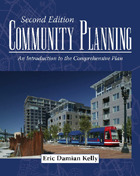
Written by a former president of the American Planning Association, Community Planning is thorough, specific, and timely. It addresses such important contemporary issues as sustainability, walkable communities, the role of urban design in public safety, changes in housing needs for a changing population, and multi-modal transportation planning. Unlike competing books, it addresses all of these topics in the context of the local comprehensive plan.
There is a broad audience for this book: planning students, practicing planners, and individual citizens who want to better understand local planning and land use controls. Boxes at the end of each chapter explain how professional planners and individual citizens, respectively, typically engage the issues addressed in the chapter. For all readers, Community Planning provides a pragmatic view of the comprehensive plan, clearly explained by a respected authority.
This fascinating book examines the Regional Planning Association of America (RPAA), a loosely organized association of ambitious and influential planners who hoped to guide the new urban and industrial developments of the early twentieth century and thereby design a radically improved America. After discussing the roots of this effort in the Progressive and World War I periods, Edward K. Spann traces the development of the RPAA from its formation in 1923 through the decades of its greatest effort (which ended in 1934) to its decline and ultimate demise in the late 1930s. Taking a biographical approach and drawing on both published works and private correspondence, the book focuses on the richly varied thoughts and activities of the leading members of the RPAA regarding significant aspects of urban and regional planning.
The members of the RPAA discussed here include Charles Harris Whitaker, Frederick L. Ackerman, Robert D. Kohn, Benton MacKaye, Clarence Stein, Lewis Mumford, Henry Wright, Robert Bruere, Stuart Chase, Edith Elmer Wood, and Catherine Bauer. Spann threads together the philosophies and work of these individuals by focusing on important points in the movement's history, such as the emergence of a community housing movement in World War I, the development of Benton MacKaye's seminal idea of the Appalachian Trail as an instrument for rural reconstruction, and Lewis Mumford's efforts to foster the idealism he thought necessary for successful planning. Spann also looks at Clarence Stein's work with regional planning in New York State during the governorship of Alfred E. Smith; the birth of the RPAA and its early publicity efforts, which culminated in the famous regional planning issue of Survey Graphic; the RPAA's differences with the Regional Plan of New York; the relationship between the RPAA and Franklin Delano Roosevelt during the Great Depression; and the early years of the Tennessee Valley Authority.
This work should appeal not only to students of city and regional planning, of architecture, and of environmentalism, but to all those interested in the intellectual developments of the period between 1914 and 1938, especially as they relate to an important phase of modernization in the United States.
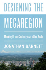
In Designing the Megaregion, planning and urban design expert Jonathan Barnett describes how to redesign megaregional growth using mostly private investment, without having to wait for massive government funding or new governmental structures. Barnett explains practical initiatives to make new development fit into its environmental setting, especially important as the climate changes; reorganize transportation systems to pull together all the components of these large urban regions; and redirect the market forces which are making megaregions very unequal places.
There is an urgent need to begin designing megaregions, and Barnett shows that the ways to make major improvements are already available.
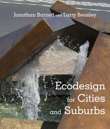
Jonathan Barnett and Larry Beasley seek to demonstrate that a sustainable built and natural environment can be achieved through ecodesign, which integrates the practice of planning and urban design with environmental conservation, through normal business practices and the kinds of capital programs and regulations already in use in most communities. Ecodesign helps adapt the design of our built environment to both a changing climate and a rapidly growing world, creating more desirable places in the process.
In six comprehensively illustrated chapters, the authors explain ecodesign concepts, including the importance of preserving and restoring natural systems while also adapting to climate change; minimizing congestion on highways and at airports by making development more compact, and by making it easier to walk, cycle and take trains and mass transit; crafting and managing regulations to insure better placemaking and fulfill consumer preferences, while incentivizing preferred practices; creating an inviting and environmentally responsible public realm from parks to streets to forgotten spaces; and finally how to implement these ecodesign concepts.
Throughout the book, the ecodesign framework is demonstrated by innovative practices that are already underway or have been accomplished in many cities and suburbs—from Hammarby Sjöstad in Stockholm to False Creek North in Vancouver to Battery Park City in Manhattan, as well as many smaller-scale examples that can be adopted in any community.
Ecodesign thinking is relevant to anyone who has a part in shaping or influencing the future of cities and suburbs – designers, public officials, and politicians.
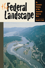
Historian Gerald D. Nash has written the first account of the epic growth of the economy of the American West during the twentieth century, showing how national interests shaped the West over the course of the past hundred years. In a book written for a broad readership, he tells the story of how America’s hinterland became the most dynamic and rapidly growing part of the country.
The Federal Landscape relates how in the nineteenth century the West was largely developed by individual enterprise but how in the twentieth Washington, D.C., became the central player in shaping the region. Nash traces the development of this process during the Progressive Era, World War I, the New Deal, World War II, the affluent postwar years, and the cold-war economy of the 1950s. He analyzes the growth of western cities and the emergence of environmental issues in the 1960s, the growth of a vibrant Mexican-U.S. border economy, and the impact of large-scale immigration from Latin America and Asia at century’s end.
Although specialists have studied many particular facets of western growth, Nash has written the only book to provide a much-needed overview of the subject. By addressing subjects as diverse as public policy, economic development, environmental and urban issues, and questions of race, class, and gender, he puts the entire federal landscape in perspective and shows how the West was really won.

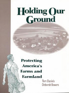
Farmers, who own or rent most of the private land in America, hold the key not only to the nation's food supply, but also to managing community growth, maintaining an attractive landscape, and protecting water and wildlife resources.
While the issue of protecting farmland and open space is not new, the intensity of the challenge has increased. Farmers are harder pressed to make a living, and rural and suburban communities are struggling to accommodate increasing populations and the development that comes with them. Holding Our Ground can help landowners and communities devise and implement effective strategies for protecting farmland. The book:
- discusses the reasons for protecting farmland and how to make those reasons widely known and understood
- describes the business of farming, federal government farm programs, and the role of land in farmers's decisions
- analyzes federal, state, and local farmland protection efforts and techniques
- explores a variety of land protection options including purchase of development rights; transfer of development rights; private land trusts; and financial, tax, and estate planning
- reviews the strengths and weaknesses of the farmland protection tools available
Holding Our Ground provides citizens, elected officials, planners, and landowners with a solid basis for understanding the issues behind farmland protection, and will be an invaluable resource in developing techniques and programs for achieving long-term protection goals.


One of the great debates of our time concerns the predominant form of land use in America today -- the all too familiar pattern of commercial and residential development known as sprawl. But what do we really know about sprawl? Do we know what it is? Where did it come from? Is it really so bad? If so, what are the alternatives? Can anything be done to make it better? The Limitless City offers an accessible examination of those and related questions. Oliver Gillham, an architect and planner with more than twenty-five years of experience in the field, considers the history and development of sprawl and examines current debates about the issue. The book:
- offers a comprehensive definition of sprawl in America
- traces the roots of sprawl and considers the factors that led to its preeminence as an urban and suburban form
- reviews both its negative impacts (loss of open space, increased pollution, gridlock) as well as its positive aspects (economic development, personal freedom, privacy)
- considers responses to sprawl including "smart growth," urban growth boundaries, regional planning, and the New Urbanism
- looks at what can be done to improve and counterbalance sprawl
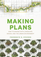
“Community and regional planning involve thinking ahead and formally envisioning the future for ourselves and others,” according to Frederick R. Steiner. “Improved plans can lead to healthier, safer, and more beautiful places to live for us and other species. We can also plan for places that are more just and more profitable. Plans can help us not only to sustain what we value but also to transcend sustainability by creating truly regenerative communities, that is, places with the capacity to restore, renew, and revitalize their own sources of energy and materials.”
In Making Plans, Steiner offers a primer on the planning process through a lively, firsthand account of developing plans for the city of Austin and the University of Texas campus. As dean of the UT School of Architecture, Steiner served on planning committees that addressed the future growth of the city and the university, growth that inevitably overlapped because of UT’s central location in Austin. As he walks readers through the planning processes, Steiner illustrates how large-scale planning requires setting goals and objectives, reading landscapes, determining best uses, designing options, selecting courses for moving forward, taking actions, and adjusting to changes. He also demonstrates that planning is an inherently political, sometimes messy, act, requiring the intelligence and ownership of the affected communities. Both wise and frank, Making Plans is an important philosophical and practical statement on planning by a leader in the field.
Communities across the country are turning to the concept of "growth management" to help plan for the future, as they seek to control the location, impact, character and timing of development in order to balance environmental and economic needs and concerns. Managing Growth in America's Communities presents practical information about proven strategies, programs and techniques of growth management for urban and rural communities. Topics examined include:
- public roles in community development
- determining locations and character of future development
- protecting environmental and natural resources
- managing infrastructure development
- preserving community character and quality
- achieving economic and social goals
- property rights concerns
Managing Growth in America's Communities is essential reading for community development specialists including government officials, planners, environmentalists, designers, developers, business people, and concerned citizens seeking innovative and feasible ways to manage growth.
Growth management is essential today, as communities seek to control the location, impact, character, and timing of development in order to balance environmental and economic needs and concerns.
The author, who is one of the nation’s leading authorities on managing community growth, provides examples from dozens of communities across the country, as well as state and regional approaches. Brief profiles present overviews of specific problems addressed, techniques utilized, results achieved, and contact information for further research. Informative sidebars offer additional perspectives from experts in growth management, including Robert Lang, Arthur C. Nelson, Erik Meyers, and others.
In particular, he considers issues of population growth, eminent domain, and the importance of design, especially green design. He also reports on the latest ideas in sustainable development, smart growth, neighborhood design, transit-oriented development, and green infrastructure planning. Like its predecessor, the second edition of Managing Growth in America’s Communities is essential reading for anyone who is interested in how communities can grow intelligently.
The concept of “the city” —as well as “the state” and “the nation state” —is passé, agree contributors to this insightful book. The new scale for considering economic strength and growth opportunities is “the megaregion,” a network of metropolitan centers and their surrounding areas that are spatially and functionally linked through environmental, economic, and infrastructure interactions.
Recently a great deal of attention has been focused on the emergence of the European Union and on European spatial planning, which has boosted the region’s competitiveness. Megaregions applies these emerging concepts in an American context. It addresses critical questions for our future: What are the spatial implications of local, regional, national, and global trends within the context of sustainability, economic competitiveness, and social equity? How can we address housing, transportation, and infrastructure needs in growing megaregions? How can we develop and implement the policy changes necessary to make viable, livable megaregions?
By the year 2050, megaregions will contain two-thirds of the U.S. population. Given the projected growth of the U.S. population and the accompanying geographic changes, this forward-looking book argues that U.S. planners and policymakers must examine and implement the megaregion as a new and appropriate framework.
Contributors, all of whom are leaders in their academic and professional specialties, address the most critical issues confronting the U.S. over the next fifty years. At the same time, they examine ways in which the idea of megaregions might help address our concerns about equity, the economy, and the environment. Together, these essays define the theoretical, analytical, and operational underpinnings of a new structure that could respond to the anticipated upheavals in U.S. population and living patterns.

The fate of Cleveland, Ohio, rides on a web of interdependencies on a regional scale. People and communities throughout that area of Ohio are being forced to adjust to new civic roles. The city of Cleveland must understand how it fits into Greater Cleveland. And suburbs must understand their dependence on the historic central city and be drawn into the Cleveland community.
In this sweeping study by local and national experts, these and more specific issues are raised and examined in depth. The New American City Faces Its Regional Future captures the dynamic thinking concerned with Cleveland and its surrounding region. The authors address questions of importance not only to Cleveland and its region but also to communities across the country that are facing similar issues. How does the city want to grow in the future? How can it become a more livable community? As the population of the region moves farther and farther out from the established urban areas, consuming more and more land, and as it enters its third century, these questions will need to be addressed. This book takes some first, important steps toward providing the answers.
The book's contributors include the most well-known experts in the planning and design fields, among them James Howard Kunstler, Alex Garvin, Andres Duany, Joel Kotkin, and Wendell Cox. These and other prominent thinkers offer passionate debates and thought-provoking commentary on the most important and controversial topics in the field of urban planning and design: gentrification, eminent domain, the philosophical divide between the Smart Growth community, libertarians and New Urbanists, regional growth patterns, urban design trends, transportation systems, and reaction to disasters such as Katrina and 9/11 that changed the way we look at cities and security.
Planetizen's Contemporary Debates in Urban Planning provides readers with a unique and accessible introduction to a broad array of ideas and perspectives. With the increasing awareness of the need for sound urban planning to ensure the economic, environmental, and social health of modern society, Planetizen's Contemporary Debates in Urban Planning gives professionals in the field and concerned citizens alike a deeper understanding of the critical, complex issues that continue to challenge urban planners, designers, and developers.
Across the United States, issues such as sustainability, smart growth, and livable communities are making headlines. Planning for a New Century brings together leading thinkers in the fields of planning, urban design, education, welfare, and housing to examine those issues and to consider the ways in which public policies have helped create—and can help solve—many of the problems facing our communities.
Each chapter identifies issues, provides background, and offers specific policy suggestions for federal, state, and local initiatives. Topics examined include:
- the relation of existing growth management policies to social equity, as well as how regional growth management measures can make new development more sustainable
- how an obscure technical procedure in highway design becomes a de facto regional plan
- ways in which local governments can promote environmental preservation and better-designed communities by rewriting local zoning and subdivision ordinances
- why alleviating housing shortages and slum conditions has resulted in a lack of affordable housing, and how that problem can be solved
- how business improvement districts can make downtowns cleaner, safer, and more welcoming to workers and visitors
In addition, the book features chapters on public safety, education, and welfare reform that include proposals that will help make regional growth management easier as inner-city crime is reduced, schools are improved, and concentrations of extreme poverty are eliminated.
Planning for the New Century brings together current academic research with pressing public policy concerns, and will be a useful resource for policymakers at all levels of government, for planners and architects, and for students and scholars of urban planning and design, and urban studies.
A significant consequence of the development of natural landscapes is habitat loss and fragmentation that results in widespread loss of biological diversity. While scientists have made great strides in determining principles and concepts fundamental to preserving biodiversity, their work will have little impact unless it is understood and implemented by those who are making on-the-ground decisions about land use.
Planning for Biodiversity provides an accessible introduction to ecological concepts for planning professionals and students. Sheila Peck explains why planners should be concerned with habitat preservation and presents practical approaches to incorporating conservation principles into planning efforts. The book.
introduces a clear framework for understanding biodiversity explains concepts related to ecosystem structure and function discusses the effects of size and connectivity on habitat quality and species movement suggests conservation priorities at different scales presents elements of reserve design examines types and sources of information considers the causes of uncertainty in biodiversity planning and the need for monitoring and adaptive management.
In each chapter, Peck presents case studies that explore the practical implications of the concepts examined, and provides contact information for each group involved in the case. Case studies include the Beaverhead/Deerlodge National Forest, Montana; Pinhook Swamp Linkage, northeastern Florida; National Gap Analysis Program; CALFED Bay-Delta Program, California; and numerous others. In addition, she includes planning guidelines which summarize the main points of the chapters, and a useful glossary of ecological terms.
Planning for Biodiversity synthesizes and explains important ecological concepts and represents the first guide for planners that clearly details how to incorporate conservation plans into their work. Planners, landscape architects and designers, planning and design students, developers, local officials, and anyone interested in designing and developing more ecologically sound land-use projects will find the book an invaluable resource.
In tandem with an analysis of the basic purpose and rationale of urban planning, Peter Self discusses the achievements and failures of different types of planning authorities. Planning the Urban Region surveys in turn the planning of city governments, metro governments, and regional bodies as they attempt to guide the growth and character of large urban areas—within whose sprawl live roughly one-half of the populations of Western countries—with examples drawn from the United States, Great Britain, Canada, Australia, Sweden, and France.
Self argues that the urban region is at a political and organizational crossroads, as it must grapple with the problems of urban sprawl: the social effects of land use and housing, conflicts between local communities and the metro organizations, environmental issues, and the capacity of governmental systems to handle complex issues. Planning the Urban Region is a valuable contribution to the literature on the future of cities and urban regions and should materially inform the debate on the place of public planning in shaping that future.
Portland, Oregon, is often cited as one of the most livable cities in the United States and a model for "smart growth." At the same time, critics deride it as a victim of heavy-handed planning and point to its skyrocketing housing costs as a clear sign of good intentions gone awry. Which side is right? Does Portland deserve the accolades it has received, or has hype overshadowed the real story?
In The Portland Edge, leading urban scholars who have lived in and studied the region present a balanced look at Portland today, explaining current conditions in the context of the people and institutions that have been instrumental in shaping it. Contributors provide empirical data as well as critical insights and analyses, clarifying the ways in which policy and planning have made a difference in the Portland metropolitan region.
Because of its iconic status and innovative approach to growth, Portland is an important case study for anyone concerned with land use and community development in the twenty-first century. The Portland Edge offers useful background and a vital overview of region, allowing others to draw lessons from its experience.
Practical Ecology for Planners, Developers, and Citizens introduces and explains key ecological concepts for planners, landscape architects, developers, and others involved in planning and building human habitats. The book is tailored to meet the needs of busy land use professionals and citizens seeking a concise yet thorough overview of ecology and its applications. It offers clear guidelines and a wealth of information on how we can protect species and ecosystems while at the same creating healthy, sustainable human communities.
Throughout the book, the authors make ecological concepts accessible to readers with little or no scientific background. They present key ideas and information in simple and pragmatic terms, and provide numerous graphics to help explain important concepts. They also offer exercises for the reader to practice ecologically-based planning and design, along with a list of resources for practical information on ecology and conservation.
Practical Ecology for Planners, Developers, and Citizens will raise the level of ecological understanding among land use professionals and citizens, and is an invaluable new resource for anyone concerned with human land use and its environmental impacts.
In Practicing Utopia, Rosemary Wakeman gives us a sweeping view of the new town movement as a global phenomenon. From Tapiola in Finland to Islamabad in Pakistan, Cergy-Pontoise in France to Irvine in California, Wakeman unspools a masterly account of the golden age of new towns, exploring their utopian qualities and investigating what these towns can tell us about contemporary modernization and urban planning. She presents the new town movement as something truly global, defying a Cold War East-West dichotomy or the north-south polarization of rich and poor countries. Wherever these new towns were located, whatever their size, whether famous or forgotten, they shared a utopian lineage and conception that, in each case, reveals how residents and planners imagined their ideal urban future.
Regional Plan Association, the nation's oldest regional planning organization, has worked since 1929 to improve the quality of life in the New York-New Jersey-Connecticut metropolitan area. The Association has crafted two long-term plans and successfully promoted their implementation through advocacy and coalition building.
The Association's Third Regional Plan describes a series of key initiatives aimed at not only improving quality of life, but also at increasing economic competitiveness, encouraging more sustainable patterns of growth, and expanding opportunities and choice in employment, housing, and community.
The Plan presents five major campaigns, each of which combines the goals of economic, equity, and environmental improvements. They are:
- Greensward -- to protect and restore large natural resource systems at the periphery of urbanized areas
- Centers -- to "recenter" regions that have experienced decades of sprawl growth
- Mobility -- to transform existing transit infrastructure to create a regional express rail network that would dramatically improve public transit, reduce highway congestion, and speed freight movement
- Workforce -- to provide the region's workforce with the skills and opportunities needed to participate in the economy of the future
- Governance -- to rationalize the activities of existing authorities, encourage service sharing among municipal governments, and encourage more effective state and regional land-use planning programs
While focusing on the New York-New Jersey-Connecticut metropolitan area, the Plan's broad themes have universal applicability to regions throughout the industrialized world.
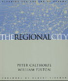
Most Americans today do not live in discrete cities and towns, but rather in an aggregation of cities and suburbs that forms one basic economic, multi-cultural, environmental and civic entity. These “regional cities” have the potential to significantly improve the quality of our lives--to provide interconnected and diverse economic centers, transportation choices, and a variety of human-scale communities. In The Regional City, two of the most innovative thinkers in the field of land use planning and design offer a detailed look at this new metropolitan form and explain how regional-scale planning and design can help direct growth wisely and reverse current trends in land use. The authors:
- discuss the nature and underpinnings of this new metropolitan form
- present their view of the policies and physical design principles required for metropolitan areas to transform themselves into regional cities
- document the combination of physical design and social and economic policies that are being used across the country
- consider the main factors that are shaping metropolitan regions today, including the maturation of sprawling suburbs and the renewal of urban neighborhoods .
Featuring full-color graphics and in-depth case studies, The Regional City offers a thorough examination of the concept of regional planning along with examples of successful initiatives from around the country. It will be must reading for planners, architects, landscape architects, local officials, real estate developers, community development professionals, and for students in architecture, urban planning, and policy.
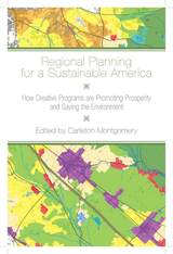
Regional Planning for a Sustainable America is the first book to represent the great variety of today’s effective regional planning programs, analyzing dozens of regional initiatives across North America.
The American landscape is being transformed by poorly designed, sprawling development. This sprawl—and its wasteful resource use, traffic, and pollution—does not respect arbitrary political boundaries like city limits and state borders. Yet for most of the nation, the patterns of development and conservation are shaped by fragmented, parochial local governments and property developers focused on short-term economic gain. Regional planning provides a solution, a means to manage human impacts on a large geographic scale that better matches the natural and economic forces at work. By bringing together the expertise of forty-two practitioners and academics, this book provides a practical guide to the key strategies that regional planners are using to achieve truly sustainable growth.
"A remarkable and timely book. . . . Must reading." William Julius Wilson
Offering a new vision of community-based regionalism, this book arrives just as "smart growth" measures and other attempts to link cities and suburbs are beginning to make their mark on the political and analytical scene. The authors make a powerful case for emphasizing equity, arguing that metropolitan areas must reduce poverty in order to grow and that low-income individuals must make regional connections in order to escape poverty.
A hard-hitting analysis of Los Angeles demonstrates that the roots of the unrest of 1992 lay in regional economic deterioration and that the recovery was slowed by insufficient attention to the poor. Regions That Work then provides a history and critique of community-development corporations, a statistical analysis of the poverty-growth relationship in seventy-four metro areas, a detailed study of three regions that have produced superior equity outcomes, and a provocative call for new policies and new politics.
Eisinger’s meticulous research uncovers state and local governments’ transition from supply-side to demand-side strategies of market creation. He shows that, instead of relying solely on the supply-side strategies of tax breaks and other incentives to encourage business relocation, some governments promoted innovation and the creation of new business approaches.
Rural Environmental Planning for Sustainable Communities offers an explanation of the concept of Rural Environmental Planning (REP) along with case studies that show how to apply REP to specific issues such as preserving agricultural lands, planning river and lake basins, and preserving historical sites.
Analyzes and compares the rapid growth of medium-sized cities.
Over the past thirty years, transnational investment, trade, and government policies have encouraged the decentralization of national economies, disrupting traditional patterns of urban and regional growth. Many smaller cities-such as Seattle, Washington; Campinas, Brazil; Oita, Japan; and Kumi, Korea-have grown markedly faster than the largest metropolitan regions. These “second tier cities” are home to specialized industrial complexes that have taken root, provided significant job growth, and attracted mobile capital and labor.
The culmination of an ambitious five-year, fourteen-city research project conducted by an international team of economists and geographers, Second Tier Cities examines the potential of these new regions to balance uneven regional development, create good, stable jobs, and moderate hyper-urbanization. Comparing across national borders, the contributors describe four types of second tier cities: Marshallian industrial districts, hub-and-spoke cities, satellite platforms, and government-anchored complexes. They find that both industrial and regional policies have been important contributors to the rise of second tier cities, though the former often trump the latter. Lessons for local, national, and international policymakers are drawn. The authors are critical of devolution and argue that it must be accompanied by strong labor and environmental standards and mechanisms to overcome differential regional resource endowments.Contributors: Clelio Campolina Diniz, U Federal de Minas Gerais, Brazil; Masatomi Funaba, Kobe U of Commerce, Japan; Elyse Golob, NYC Economic Development Goup; Mia Gray, Cambridge U; Jun Ho Jeong, Oxford U; Sam Ock Park, Seoul National U; Mohammad Razavi; Fabiana Borges T. Santos, U Federal de Minas Gerais, Brazil; and Masayuki Sasaki, Kanzawa U, Japan.
“Economic and political forces no longer combat poverty—they generate poverty!" exclaim William Goldsmith and Edward Blakely in their report on the plight of American's urban poor. In this revised and updated edition of their 1992 book Separate Societies,the authors present a compelling examination of the damaging divisions that isolate poor city minority residents from the middle-class suburban majority. They pay special attention to how the needs of the permanently poor have been unmet through the alternating years of promises and neglect, and propose a progressive turn away from 30 years of conservative policies.
Separate Societies vividly documents how the urban working class has been pushed out of industrial jobs through global economic restructuring, and how the Wall Street meltdown has aggravated underemployment, depleted public services, and sharpened racial and class inequalities.
The authors insist that the current U.S. approach puts Americans out of work and lowers the standard of living for all. As such, Goldsmith and Blakely urge the Obama administration to create better urban policy and foster better metropolitan management to effectively and efficiently promote equality.
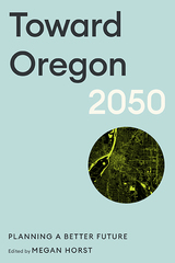
In this compelling volume, leading experts in land use and urban planning, in cooperation with other scholars and community partners, envision various possible futures and begin the work of developing statewide plans to guide Oregon through the decades ahead. Building on the state’s policy innovation and planning legacy, contributors to Toward Oregon 2050 address current challenges such as housing scarcity, income inequality, the rural-urban divide, and climate change. They offer recommendations on a range of issues, from culture to incarceration, transportation to voting rights, all with the goal of imagining what a fair and equitable Oregon might look like.
Some of the imagined futures—with worsening effects of climate change, environmental harms, and social inequities—are not bright for many Oregonians. Other futures include enhanced resiliency to forest fires and flooding, more Oregonians in high-paying jobs and in secure housing, and more children walking and biking to school. But those positive futures are not guaranteed, and getting there won’t be easy. They’ll require all stakeholders—state and local government, members of all political parties, private businesses, non-profit organizations, and individual residents—to play a role in ensuring a better future for the next generation of Oregonians.
Intended for all Oregonians who care about their state’s future, Toward Oregon 2050 will also appeal to scholars and planners who have long looked to Oregon for inspiration and lessons learned. The book invites readers to envision the future of Oregon and to contribute their part toward a better future for the state.
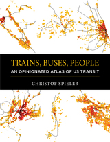
In the US, the 25 largest metropolitan areas and many smaller cities have fixed guideway transit—rail or bus rapid transit. Nearly all of them are talking about expanding. Yet discussions about transit are still remarkably unsophisticated. To build good transit, the discussion needs to focus on what matters—quality of service (not the technology that delivers it), all kinds of transit riders, the role of buildings, streets and sidewalks, and, above all, getting transit in the right places.
Christof Spieler has spent over a decade advocating for transit as a writer, community leader, urban planner, transit board member, and enthusiast. He strongly believes that just about anyone—regardless of training or experience—can identify what makes good transit with the right information. In the fun and accessible Trains, Buses, People: An Opinionated Atlas of US Transit, Spieler shows how cities can build successful transit. He profiles the 47 metropolitan areas in the US that have rail transit or BRT, using data, photos, and maps for easy comparison. The best and worst systems are ranked and Spieler offers analysis of how geography, politics, and history complicate transit planning. He shows how the unique circumstances of every city have resulted in very different transit systems.
Using appealing visuals, Trains, Buses, People is intended for non-experts—it will help any citizen, professional, or policymaker with a vested interest evaluate a transit proposal and understand what makes transit effective. While the book is built on data, it has a strong point of view. Spieler takes an honest look at what makes good and bad transit and is not afraid to look at what went wrong. He explains broad concepts, but recognizes all of the technical, geographical, and political difficulties of building transit in the real world. In the end,Trains, Buses, People shows that it is possible with the right tools to build good transit.
-Planning
In some US and Canadian cities, transit has quietly been expanding and improving over the last few years, despite funding and ridership challenges. How do we assess the advances and failures of our current systems to move forward strategically and wisely?
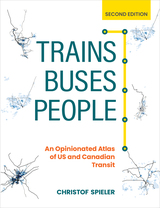
The first edition of Trains, Buses, People was dubbed “a transit wonk’s bible” and guided “a smarter conversation about urban transit” in the US. This second edition is fully updated and expanded to include eight Canadian cities and two new US cities (Indianapolis and San Juan, Puerto Rico).
In Trains, Buses, People, Second Edition: An Opinionated Atlas of US and Canadian Transit, transit expert and “transportation hero” Christof Spieler provides a new section on inclusivity to help agencies understand how to welcome riders regardless of race, gender, income, or disability. Select cities include new maps overlaying transit and poverty data, and systems that have started construction since the first edition in 2018 have been added. Other new sections address network typologies, guideway types, station types, and fares.
Spieler has spent over a decade advocating for transit as a writer, community leader, urban planner, transit board member, and enthusiast. He strongly believes that just about anyone—regardless of training or experience—can identify what makes good transit with the right information. In the fun, accessible, and visually appealing Trains, Buses, People, Second Edition: An Opinionated Atlas of US and Canadian Transit, Spieler shows how cities can build successful transit. He profiles the 49 metropolitan areas in the US and eight metropolitan areas in Canada that have rail transit or BRT, using data, photos, and maps for easy comparison. Spieler ranks the best and worst systems and he offers analysis of how geography, politics, and history complicate transit planning. He shows how the unique circumstances of every city have resulted in very different transit systems.
Trains, Buses, People, Second Edition is intended for non-experts—it will help any citizen, professional, or policymaker with a vested interest evaluate a transit proposal and understand what makes transit effective. It shows that it is possible, with the right tools, to build good transit.

Divided into three sections, this edition of Urban Land Use Planning deftly balances an authoritative, up-to-date discussion of current practices with a vision of what land use planning should become. It explores the societal context of land use planning and proposes a model for understanding and reconciling the divergent priorities among competing stakeholders; it explains how to build planning support systems to assess future conditions, evaluate policy choices, create visions, and compare scenarios; and it sets forth a methodology for creating plans that will influence future land use change.
Discussions new to the fifth edition include how to incorporate the three Es of sustainable development (economy, environment, and equity) into sustainable communities, methods for including livability objectives and techniques, the integration of transportation and land use, the use of digital media in planning support systems, and collective urban design based on analysis and public participation.
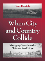
Strips of urban and suburban "fabric" have extended into the countryside, creating a ragged settlement pattern that blurs the distinction between rural, urban, and suburban. As traditional rural industries like farming, forestry, and mining rapidly give way to residential and commercial development, the land at the edges of developed areas -- the rural-urban fringe -- is becoming the middle landscape between city and countryside that the suburbs once were.
When City and Country Collide examines the fringe phenomenon and presents a workable approach to fostering more compact development and better, more sustainable communities in those areas. It provides viable alternatives to traditional land use and development practices, and offers a solid framework and rational perspective for wider adoption of growth management techniques.
The author:
- reviews growth management techniques and obstacles to growth management
- examines the impact of federal spending programs and regulations on growth management
- presents a comprehensive planning process for communities and counties
- discusses state-level spending programs and regulations
- illustrates design principles for new development
- looks at regional planning efforts and regional governments
- discusses ways to protect farmland, forestland, and natural areas to help control sprawl
The book also features a series of case studies -- including Albuquerque, New Mexico; Larimer County, Colorado; Chittenden County, Vermont; and others -- that evaluate the success of efforts to control both the size of the fringe and growth within the fringe. It ends with a discussion of possible futures for fringe areas.
When City and Country Collide is an important guide for planners and students of planning, policymakers, elected officials, and citizens working to minimize sprawl.
READERS
Browse our collection.
PUBLISHERS
See BiblioVault's publisher services.
STUDENT SERVICES
Files for college accessibility offices.
UChicago Accessibility Resources
home | accessibility | search | about | contact us
BiblioVault ® 2001 - 2024
The University of Chicago Press


