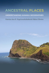
Katrina-Ann R. Kapa‘anaokalaokeola Nakoa Oliveira elucidates a Kanaka geography and provides contemporary scholars with insights regarding traditional culture—including the ways in which Kanaka utilize cartographic performances to map our ancestral places and retain our mo‘olelo, such as reciting creation accounts, utilizing nuances embedded in language, and dancing hula.
A Kanaka by birth, a kumu ‘olelo Hawai‘i (language teacher) by profession, and a geographer by training, Oliveira’s interests intersect at the boundary where words and place-making meet her ancestral land. Thus, Ancestral Places imbues the theoretical with sensual practice. The book’s language moves fluidly between Hawaiian and English, terms are nimbly defined, and the work of the field is embodied: geographic layers are enacted within the text, new understandings created—not just among lexica, but amidst illustrations, charts, terms, and poetry.
In Ancestral Places, Oliveira reasserts both the validity of ancestral knowledge systems and their impact in modernity. Her discussion of Kanaka geographies encompasses the entire archipelago, offering a new framework in Kanaka epistemology.
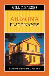
For this first toponymic encyclopedia of Arizona, Barnes compiled information from published histories, federal and state government documents, and reminiscences of "old timers, Indians, Mexicans, cowboys, sheep-herders, historians, any and everybody who had a story to tell as to the origin and meaning of Arizona names." The result is a book chock full of oddments, humor, and now-forgotten lore, which belongs on the night table as well as in the glove compartment.
Barnes' original Arizona Place Names has become a booklover's favorite and is much in demand. The University of Arizona Press is pleased to reissue this classic of Arizoniana, which remains as useful and timeless as it was more than half a century ago.

Surprising, entertaining, and illuminating, this is essential reading for armchair travelers and word nerds. Our dictionaries are full of hidden histories, tales, and adventures from all over the world—if you know where to look.

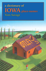
Savage includes information on the place-names of all 1,188 incorporated and unincorporated communities in Iowa that meet at least two of the following qualifications: twenty-five or more residents; a retail business; an annual celebration or festival; a school; church, or cemetery; a building on the National Register of Historic Places; a zip-coded post office; or an association with a public recreation site. If a town’s name has changed over the years, he provides information about each name; if a name’s provenance is unclear, he provides possible explanations. He also includes information about the state’s name and about each of its ninety-nine counties as well as a list of ghost towns. The entries range from the counties of Adair to Wright and from the towns of Abingdon to Zwingle; from Iowa’s oldest town, Dubuque, starting as a mining camp in the 1780s and incorporated in 1841, to its newest, Maharishi Vedic City, incorporated in 2001.
The imaginations and experiences of its citizens played a role in the naming of Iowa’s communities, as did the hopes of the huge influx of immigrants who settled the state in the 1800s. Tom Savage’s dictionary of place-names provides an appealing genealogical and historical background to today’s map of Iowa.
“It is one of the beauties of Iowa that travel across the state brings a person into contact with so many wonderful names, some of which a traveler may understand immediately, but others may require a bit of investigation. Like the poet Stephen Vincent Benét, we have fallen in love with American names. They are part of our soul, be they family names, town names, or artifact names. We identify with them and are identified with them, and we cannot live without them. This book will help us learn more about them and integrate them into our beings.”—from the foreword by Loren N. Horton
“Primghar, O’Brien County. Primghar was established by W. C. Green and James Roberts on November 8, 1872. The name of the town comes from the initials of the eight men who were instrumental in developing it. A short poem memorializes the men and their names:
Pumphrey, the treasurer, drives the first nail;
Roberts, the donor, is quick on his trail;
Inman dips slyly his first letter in;
McCormack adds M, which makes the full Prim;
Green, thinking of groceries, gives them the G;
Hayes drops them an H, without asking a fee;
Albright, the joker, with his jokes all at par;
Rerick brings up the rear and crowns all ‘Primghar.’
Primghar was incorporated on February 15, 1888.”
For fifty years geographer Wilbur Zelinsky has charted the social, cultural, and historical map of the American experience. A self-confessed incurable landscape voyeur, he has produced order and pattern from massive amounts of data, zestfully finding societal meaning in the terra incognita of our postmodern existence. Now he has gathered his most original and exciting explorations into a volume that captures the nature and dynamics of this remarkable phenomenon we call the United States of America. Each the product of Zelinsky's joyous curiosity, these energetic essays trace the innermost contours of our bewildering American reality.
A compendium of Indian-derived names from the three languages of the Muskhogean family—Seminole, Hitchiti, and Choctaw.
The first Native peoples of what is now the United States who met and interacted with Europeans were the people of the lower Southeast. They were individuals of the larger Maskókî linguistic family who inhabited much of present-day Florida, Georgia, Alabama, Mississippi, South Carolina, and eastern portions of Tennessee, Kentucky, and Louisiana. Today, sixteen federally recognized tribes trace their heritage from these early Maskókî peoples, and many of them in both Florida and Oklahoma still speak and understand this root language.
The continuing vitality of this core language, and of Seminole culture and influence, makes this linguistic examination by William Read ever more valuable. A companion to his study of Indian Place Names in Alabama, this long out-of-print guide offers a new introduction from Patricia Wickman in which she provides current understandings of Seminole language and derivations and a brief analysis of Read's contribution to the preservation of the Native linguistic record.
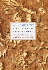
From Squaw Tit to Whorehouse Meadow probes this little-known chapter in American cartographic history by considering the intersecting efforts to computerize mapmaking, standardize geographic names, and respond to public concern over ethnically offensive appellations. Interweaving cartographic history with tales of politics and power, celebrated geographer Mark Monmonier locates his story within the past and present struggles of mapmakers to create an orderly process for naming that avoids confusion, preserves history, and serves different political aims. Anchored by a diverse selection of naming controversies—in the United States, Canada, Cyprus, Israel, Palestine, and Antarctica; on the ocean floor and the surface of the moon; and in other parts of our solar system—From Squaw Tit to Whorehouse Meadow richly reveals the map’s role as a mediated portrait of the cultural landscape. And unlike other books that consider place names, this is the first to reflect on both the real cartographic and political imbroglios they engender.
From Squaw Tit to Whorehouse Meadow is Mark Monmonier at his finest: a learned analysis of a timely and controversial subject rendered accessible—and even entertaining—to the general reader.

The myth that kamikaze, or divine winds, protected Japan against the Mongol invasions of 1274 and 1281 is linked to a belief in absolute victory in the Pacific War in the twentieth century. But what was the representation of a historical past in Japan, and what role did it play as a repertoire of cultural identity before the rise of hyper-nationalism?
The Historical Writing of the Mongol Invasions in Japan is about the names for Japan and the Mongols, the commemoration of battle sites and ancestors, and the antiquarian exchanges within confined circles in the seventeenth and eighteenth centuries. In the Tokugawa culture of appearances, historical writing and related genres affirmed status identity. In the first two-thirds of the nineteenth century, the exploits of thirteenth-century warriors served as a model for propagating revolutionary change in Japanese cities, whereas in the 1880s and 1890s, conservative associations appropriated the defense against the Mongol invasions as a symbol of patriotism. The Historical Writing of the Mongol Invasions in Japan thus points to the continuities and ruptures that marked the emergence of a national culture after the Meiji Restoration of 1868.
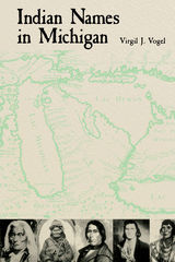
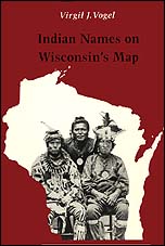
Place names are cultural artifacts that tell us as much about how people lived as do relics dug from the ground, writes Virgil Vogel, one of America's foremost authorities on place names. They are historical records from which the location and migration of people, plants, and animals can be charted. Onalaska and Aztalan, not surprisingly, are place names transplanted to Wisconsin from the far north and south. Some names tell of topographic features that have long since disappeared or are little noticed today. Beaver Dam once had an Indian name meaning just that; Sheboygan, "big pipe" in Ojibwa, described the shape of a river bend. Other names are vestiges of ancient languages nowhere else recorded. Some commemorate historic events: Winneconne is believed by many to mean "place of the skulls."
The Indian names of Wisconsin's towns, rivers, and lakes reveal the minds of the Indian peoples, their cosmic views, their values, their relation to their environment , and their ways of life and convey as well something of the history of their white invaders.
Virgil Vogel's thirty years of research into Native American influence on geographical names has resulted in an absorbing account that illuminates the history and culture of Wisconsin Indians. Vogel tells his story thematically—names from the spirit world, names of trails and portages, French-Indian personal names, tribal names, and so on—to show that place names are part of a larger cultural and natural world. In recovering the history and meaning of these names, he has restored an important and colorful part of America's heritage.
"What is the 'meaning' of names like Coosa and Tallapoosa? Who named the Alabama and Tombigbee and Tennessee rivers? How are Cheaha and Conecuh and Talladega pronounced? How did Opelika and Tuscaloosa get their names? Questions like these, which are asked by laymen as well as by historians, geographers, and students of the English language, can be answered only by study of the origins and history of the Indian names that dot the map of Alabama.—from the Foreword
Originally published by Professor Read in 1937, this volume was revised, updated, and annotated in 1984 by James B. McMillan and remains the single best compedium on the topic.

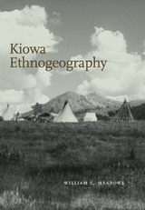
Examining the place names, geographical knowledge, and cultural associations of the Kiowa from the earliest recorded sources to the present, Kiowa Ethnogeography is the most in-depth study of its kind in the realm of Plains Indian tribal analysis. Linking geography to political and social changes, William Meadows applies a chronological approach that demonstrates a cultural evolution within the Kiowa community.
Preserved in both linguistic and cartographic forms, the concepts of place, homeland, intertribal sharing of land, religious practice, and other aspects of Kiowa life are clarified in detail. Native religious relationships to land (termed "geosacred" by the author) are carefully documented as well. Meadows also provides analysis of the only known extant Kiowa map of Black Goose, its unique pictographic place labels, and its relationship to reservation-era land policies. Additional coverage of rivers, lakes, and military forts makes this a remarkably comprehensive and illuminating guide.
His writings spanned five decades and have been instrumental across a wide range of academic disciplines. Most importantly, Read devoted a good portion of his research to the meaning of place names in the southeastern United States—especially as they related to Indian word adoption by Europeans.
This volume includes his three Louisiana articles combined: Louisiana: Louisiana Place-Names of Indian Origin (1927), More Indian Place-Names in Louisiana (1928), and Indian Words (1931). Joining Alabama's reprint of Indian Places Names in Alabama and Florida Place Names of Indian Origin and Seminole Personal Names, this volume completes the republication of the southern place name writings of William A. Read.
A linguistic history of Native American place-names in Indiana
In tracing the roots of Indiana place names, Michael McCafferty focuses on those created and used by local Native Americans. Drawing from exciting new sources that include three Illinois dictionaries from the eighteenth century, the author documents the language used to describe landmarks essential to fur traders in Les Pays d’en Haut and settlers of the Old Northwest territory. Impeccably researched, this study details who created each name, as well as when, where, how and why they were used. The result is a detailed linguistic history of lakes, streams, cities, counties, and other Indiana names. Each entry includes native language forms, translations, and pronunciation guides, offering fresh historical insight into the state of Indiana.
What are the limits and potentials of indigenous acts of spatial production? Native Space argues that control over the notion of “Indianness” still sits at the center of how space is produced in a neocolonial nation, and shows how non-indigenous communities uniquely deploy Native identities in the direct construction of colonial geographies. In short, “the Indian” serves to create White space in concrete ways. Yet, Native geographies effectively reclaim indigenous identities, assert ongoing relations to the land, and refuse the claims of settler colonialism.
Barnd creatively and persuasively uses original cartographic research and demographic data, a series of interrelated stories set in the Midwestern Plains states of Kansas and Oklahoma, an examination of visual art by contemporary indigenous artists, and discussions of several forms of indigenous activism to support his argument. With its highly original, interdisciplinary approach, Native Space makes a significant contribution to the literature in cultural and critical geography, comparative ethnic studies, indigenous studies, cultural studies, American Studies, and related fields.
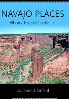
Navajoland is the heart and soul of the American Southwest. While the Navajo Reservation incorporates portions of Arizona, New Mexico, and Utah, this is only about half the traditional homeland of 220,000 Diné, the People. In one way or another, nearly all of it, including the original homeland, is sacred to them. Before Spaniards and Americans affixed their own names to the land, every topographic feature had at least one Navajo name. Many of these made their way onto maps—in various forms—or are still in use among Navajo speakers.
Navajo Places is the most ambitious attempt yet to preserve this rich legacy. Through years of research, interviews, and consultation with Navajo authorities, Laurance Linford has compiled a place-name guide that goes beyond reservation boundaries to include the entirety of the traditional Navajo homeland. The volume contains over 1,200 entries, plus a pronunciation guide and sections on Navajo history and the relation of ritual and sacred legend to landscape.
An invaluable resource for anyone interested in the Four Corners region.
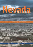
Author and researcher Helen Carlson spent almost fourteen years searching for the origins of Nevada’s place names, using the maps of explorers, miners, government surveyors, and city planners and poring through historical accounts, archival documents, county records, and newspaper files. The result of her labors is Nevada Place Names, a fascinating mixture of history spiced with folklore, legend, and obscure facts. Out of print for some years, the book was reprinted in 1999.
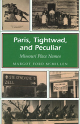
Paris, Tightwad, Peculiar, Neosho, Gasconade, Hannibal, Diamond, Quarantine, Zif, and Zig. These are just a few of the names Margot Ford McMillen covers in her lively book on the history of place names in Missouri. The origins behind the names range from humorous to descriptive:
•Tightwad, Missouri, is said to have been named after a store owner who cheated a mailman out of his rightful watermelon to make an extra fifty cents. •Plad, Missouri, was supposed to be named "Glad," but the post office printed the name wrong, and it was too much trouble to get it changed. •Some place names describe a location, such as Big Spring or Flat River. •Other names show the influence of immigrants to the state, like Hermann, which is a German name, or the Maries River, which was derived from the French. •Many places are named for people or wildlife found nearby, while others are backed up by legend or simply picked out of thin air.
The first systematic attempt to account for all the names of the counties, cities, town, water courses, bodies of water, and mountains that appear on readily available maps of Alabama
“An invaluable resource for television news and talk shows…not to mention a treasure for trivia buffs!” —Tom York, WBRC-6
Fifty years ago, educator and writer Robert E. Gard traveled across Wisconsin, learning the trivial, controversial, and landmark stories behind how cities, counties, and local places got their names. This volume records the fruits of Gard’s labors in an alphabetical listing of places from every corner of Wisconsin, and the stories behind their often-unusual names. Gard’s work provides an important snapshot of how Wisconsin residents of a bygone era came to understand the names of their towns and home places, many of which can no
longer be found on any map.
Celebrated rural historian Jerry Apps introduces this reprint of Gard’s work,
saying that in “some ways The Romance of Wisconsin Place Names is a reference book, a place where you can go to learn a little more about your home town. But in many ways it is much more than that, for it includes the stories of places throughout the state, submitted by the people who knew them. It is a book where story, people, and place all come together.”
The first two editions of Shem Pete’s Alaska contributed much to Dena’ina cultural identity and public appreciation of the Dena’ina place names network in Upper Cook Inlet. This new edition adds nearly thirty new place names to its already extensive source material from Shem Pete and more than fifty other contributors, along with many revisions and new annotations. The authors provide synopses of Dena’ina language and culture and summaries of Dena’ina geographic knowledge, and they also discuss their methodology for place name research.
Exhaustively refined over more than three decades, Shem Pete’s Alaska will remain the essential reference work on the landscape of the Dena’ina people of Upper Cook Inlet. As a book of ethnogeography, Native language materials, and linguistic scholarship, the extent of its range and influence is unlikely to be surpassed.
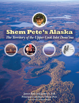
This expanded edition of Shem Pete's Alaska presents 973 named places in 16 drainage-based chapters. The names form a reconstructed network from the vantage points of the life experiences of Shem Pete and other Dena'ina and Ahtna speakers. It is annotated with comments and stories by Shem Pete and more than 50 other contributors, plus historic references, vignettes, copious photographs, historic maps, and shaded-relief placename maps. The authors provide perspective on Dena'ina language and culture, as well as a summary of Dena'ina geographic knowledge and placename research methodology.
This beautifully produced edition is a treasure for all Alaskans and for anyone interested in the "personal connectedness to a beautiful land" voiced by Dena'ina elders.
From the foreword by William Bright: "Shem Pete's experience and wisdom as an elder of the Dena'ina Athabascan Indians shine through this work like the sun—as do the skill and devotion of James Kari, James Fall, and the other Dena'ina, Ahtna, Alaska Native, and Anglo-American people who contributed to making the book a reality. . . . We have a volume that offers a vivid picture of Native Alaskan culture, history, geography, and language, with added glimpses of oral literature and music. . . . All Native American Peoples, indeed, all traditional communities in the world would be fortunate and proud to have this kind of record of their life and culture."
Space-Time Perspectives on Early Colonial Moquegua looks at the encounters between existing populations and newcomers from successive waves of colonization, from indigenous expansion states (Wari, Tiwanaku, and Inka) to the foreign Spaniards, and the way each group “re-spatialized” the landscape according to its own political and economic ends. Viewing these spatializations from political, economic, and religious perspectives, Rice considers both the ideological and material occurrences.
Concluding with a special focus on the multiple space-time considerations involved in Spanish-inspired ceramics from the region, Space-Time Perspectives on Early Colonial Moquegua integrates the local and rural with the global and urban in analyzing the events and processes of colonialism. It is a vital contribution to the literature of Andean studies and will appeal to students and scholars of archaeology, historical archaeology, history, ethnohistory, and globalization.
Was Gasoline, Texas, named in honor of a gas station? Nope, but the name does honor the town’s original claim to fame: a gasoline-powered cotton gin. Is Paris, Texas, a reference to Paris, France? Yes: Thomas Poteet, who donated land for the town site, thought it would be an improvement over “Pin Hook,” the original name of the Lamar County seat. Ding Dong’s story has a nice ring to it; the name was derived from two store owners named Bell, who lived in Bell County, of course. Tracing the turning points, fascinating characters, and cultural crossroads that shaped Texas history, Texas Place Names provides the colorful stories behind these and more than three thousand other county, city, and community names.
Drawing on in-depth research to present the facts behind the folklore, linguist Edward Callary also clarifies pronunciations (it’s NAY-chis for Neches, referring to a Caddoan people whose name was attached to the Neches River during a Spanish expedition). A great resource for road trippers and historians alike, Texas Place Names alphabetically charts centuries of humanity through the enduring words (and, occasionally, the fateful spelling gaffes) left behind by men and women from all walks of life.

John W. Van Cott has spend the better part of a lifetime searching out the answers to these questions. Now the fruits of his labor are recorded in this, the most extensive compilation of Utah place names ever published. Almost five thousand toponyms are listed alphabetically, marking the passage of peoples and cultures from earliest times. Specialists will appreciate the geographical precision of Section, Township, Range, and altitude. Generalists will recognize counties and relationships to know features. All will delight in the rich lore, often a mixture of myth and history, of the place and its name. Scholars will find useful the inclusion of synonyms, nicknames, previous names, all cross-referenced, and all tied to a bibliography of over five hundred entries.
The author concluded his work of over forty years with the observation that he hardly touched the surface of Utah’s place names, numbered at over twenty-two thousand by the U.S. Geological Survey.
READERS
Browse our collection.
PUBLISHERS
See BiblioVault's publisher services.
STUDENT SERVICES
Files for college accessibility offices.
UChicago Accessibility Resources
home | accessibility | search | about | contact us
BiblioVault ® 2001 - 2024
The University of Chicago Press


