
 A SCHOLARLY BOOK REPOSITORY
Results by Title
7 books about Turner, Raymond M.
7 books about Turner, Raymond M.
The Changing Mile
James Rodney Hastings, Raymond M. Turner
University of Arizona Press, 1965
Dramatically presents the changes man, climate, cattle, fire, and other factors have wrought upon the natural landscape within a vertical mile over a large region—the northern Sonoran Desert and the highlands within it and to the east.
[more]
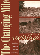
The Changing Mile Revisited
An Ecological Study of Vegetation Change with Time in the Lower Mile of an Arid and Semiarid Region
Raymond M. Turner, Robert H. Webb, Janice E. Bowers, and James Rodney Hastings
University of Arizona Press, 2003
The Changing Mile, originally published in 1965, was a benchmark in ecological studies, demonstrating the prevalence of change in a seemingly changeless place. Photographs made throughout the Sonoran Desert region in the late 1800s and early 1900s were juxtaposed with photographs of the same locations taken many decades later. The nearly one hundred pairs of images revealed that climate has played a strong role in initiating many changes in the region. This new book updates the classic by adding recent photographs to the original pairs, providing another three decades of data and showing even more clearly the extent of change across the landscape. During these same three decades, abundant information about climatic variability, land use, and plant ecology has accumulated, making it possible to determine causes of change with more confidence.
Using nearly two hundred additional triplicate sets of unpublished photographs, The Changing Mile Revisited utilizes repeat photographs selected from almost three hundred stations located in southern Arizona, in the Pinacate region of Mexico, and along the coast of the Gulf of California. Coarse photogrammetric analysis of this enlarged photographic set shows the varied response of the region's major plant species to the forces of change. The images show vegetation across the entire region at sites ranging in elevation from sea level to a mile above sea level. Some sites are truly arid, while others are located above the desert in grassland and woodland. Common names are used for most plants and animals (with Latin equivalents in endnotes) to make the book more accessible to non-technical readers.
The original Changing Mile was based upon a unique set of data that allowed the authors to evaluate the extent and magnitude of vegetation change in a large geographic region. By extending the original landmark study, The Changing Mile Revisited will remain an indispensable reference for all concerned with the fragile desert environment.
[more]
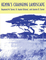
Kenya's Changing Landscape
Raymond M. Turner
University of Arizona Press, 1998
Botanist Homer L. Shantz took photographs of the Kenyan landscape in the early 1920s as part of his effort to document the natural plant cover of Africa. He returned there with B. L. Turner in the late 1950s to repeat the photographs. In 1990, Raymond Turner traveled to Kenya under the auspices of the National Geographic Society in order to match the photographs made by Shantz and B.L. Turner and to show the changes that have occurred over the decades since Shantz's initial journey. Turner's comparative photos and research into the botanical record dramatically reflect the encroachment of woody plants in arid areas and the increasing human impact in more humid locales.
Turner's discussions of the photographs and the conclusions he draws provide an important reference for ecologists, geographers, botanists, and other researchers attempting similar studies. By documenting vegetation change in a region broadly similar climatically to North America's subtropical deserts and grasslands but different in its wildlife and its human culture, the book shows that the endpoints of landscape status are similar despite the vastly different histories of these two regions of the world.
Turner's discussions of the photographs and the conclusions he draws provide an important reference for ecologists, geographers, botanists, and other researchers attempting similar studies. By documenting vegetation change in a region broadly similar climatically to North America's subtropical deserts and grasslands but different in its wildlife and its human culture, the book shows that the endpoints of landscape status are similar despite the vastly different histories of these two regions of the world.
[more]
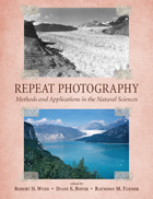
Repeat Photography
Methods and Applications in the Natural Sciences
Edited by Robert H. Webb, Diane E. Boyer, and Raymond M. Turner
Island Press, 2010
First developed in the 1880s as a way to monitor glaciers in Europe, repeat photography —the practice of taking photographs at different points in times from the same physical vantage point—remains an essential and cost-effective technique for scientists and researchers working to track and study landscape change.
This volume explores the technical and geographic scope of this important technique, focusing particularly on the intertwined influences of climatic variation and land-use practices in sculpting landscapes. Contributors offer a broad-perspective review of the state-of-the-art of repeat photography, with twenty-three chapters written by researchers around the globe who have made use of repeat photography in their work. Topics addressed include
the history of repeat photography
techniques for creating and analyzing repeat photographs
applications in the geosciences
applications in population ecology
applications in ecosystem change
cultural applications
Repeat Photography demonstrates the wide range of potential applications, examines new techniques for acquiring data from repeat photography, and clearly shows that repeat photography remains a valuable and efficient means of monitoring change in both developed and developing regions. Over one hundred sets of photographs, including thirty-two pages of color photos, serve as examples.
Recent concerns about climate change and its effects on natural landscapes, combined with ongoing concerns about land-use practices, make this state-of-the-art review a timely contribution to the literature.
[more]
Requiem for the Santa Cruz
An Environmental History of an Arizona River
Robert H. Webb, Julio L. Betancourt, R. Roy Johnson, and Raymond M. Turner; Foreword by Bernard L. Fontana
University of Arizona Press, 2014
In prehistoric times, the Santa Cruz River in what is now southern Arizona saw many ebbs, flows, and floods. It flowed on the surface, meandered across the floodplain, and occasionally carved deep channels or arroyos into valley fill. Groundwater was never far from the surface, in places outcropping to feed marshlands or ciénegas. In these wet places, arroyos would heal quickly as the river channel revegetated, the thriving vegetation trapped sediment, and the channel refilled. As readers of Requiem for the Santa Cruz learn, these aridland geomorphic processes also took place in the valley as Tucson grew from mud-walled village to modern metropolis, with one exception: historical water development and channel changes proceeded hand in glove, each taking turns reacting to the other, eventually lowering the water table and killing a unique habitat that can no longer recover or be restored.
Authored by an esteemed group of scientists, Requiem for the Santa Cruz thoroughly documents this river—the premier example of historic arroyo cutting during the late nineteenth and early twentieth centuries, when large floodflows cut down through unconsolidated valley fill to form deep channels in the major valleys of the American Southwest. Each chapter provides a unique opportunity to chronicle the arroyo legacy, evaluate its causes, and consider its aftermath. Using more than a collective century of observations and collections, the authors reconstruct the circumstances of the river’s entrenchment and the groundwater mining that ultimately killed the marshlands, a veritable mesquite forest, and a birdwatcher's paradise.
Today, communities everywhere face this conundrum: do we manage ephemeral rivers through urban areas for flood control, or do we attempt to restore them to some previous state of perennial naturalness? Requiem for the Santa Cruz carefully explores the legacies of channel change, groundwater depletion, flood control, and nascent attempts at river restoration to give a long-term perspective on management of rivers in arid lands. Tied together by authors who have committed their life’s work to the study of aridland rivers, this book offers a touching and scientifically grounded requiem for the Santa Cruz and every southwestern river.
[more]
The Ribbon of Green
Change in Riparian Vegetation in the Southwestern United States
Robert H. Webb, Stanley A. Leake, and Raymond M. Turner
University of Arizona Press, 2007
Woody wetlands constitute a relatively small but extremely important part of the landscape in the southwestern United States. These riparian habitats support more than one-third of the region’s vascular plant species, are home to a variety of wildlife, and provide essential havens for dozens of migratory animals. Because of their limited size and disproportionately high biological value, the goal of protecting wetland environments frequently takes priority over nearly all other habitat types. In The Ribbon of Green, hydrologists Robert H. Webb, and Stanley A. Leake and botanist Raymond M. Turner examine the factors that affect the stability of woody riparian vegetation, one of the largest components of riparian areas. Such factors include the diversion of surface water, flood control, and the excessive use of groundwater. Combining repeat photography with historical context and information on species composition, they document more than 140 years of change. Contrary to the common assumption of widespread losses of this type of ecosystem, the authors show that vegetation has increased on many river reaches as a result of flood control, favorable climatic conditions, and large winter floods that encourage ecosystem disturbance, germination, and the establishment of species in newly generated openings. Bringing well-documented and accessible insights to the ecological study of wetlands, this book will influence our perception of change in riparian ecosystems and how riparian restoration is practiced in the Southwest, and it will serve as an important reference in courses on plant ecology, riparian ecology, and ecosystem management.
[more]
Sonoran Desert Plants
An Ecological Atlas
Raymond M. Turner, Janice E. Bowers, and Tony L. Burgess
University of Arizona Press, 1995
The Sonoran Desert, a fragile ecosystem, is under ever-increasing pressure from a burgeoning human population. This ecological atlas of the region's plants, a greatly enlarged and full revised version of the original 1972 atlas, will be an invaluable resource for plant ecologists, botanists, geographers, and other scientists, and for all with a serious interest in living with and protecting a unique natural southwestern heritage.
An encyclopedia as well as an atlas, this monumental work describes the taxonomy, geographic distribution, and ecology of 339 plants, most of them common and characteristic trees, shrubs, or succulants. Also included is valuable information on natural history and ethnobotanical, commercial, and horticultural uses of these plants. The entry for each species includes a range map, an elevational profile, and a narrative account. The authors also include an extensive bibliography, referring the reader to the latest research and numerous references of historical importance, with a glossary to aid the general reader. Sonoran Desert Plants is a monumental work, unlikely to be superseded in the next generation. As the region continues to attract more people, there will be an increasingly urgent need for basic knowledge of plant species as a guide for creative and sustainable habitation of the area. This book will stand as a landmark resource for many years to come.
An encyclopedia as well as an atlas, this monumental work describes the taxonomy, geographic distribution, and ecology of 339 plants, most of them common and characteristic trees, shrubs, or succulants. Also included is valuable information on natural history and ethnobotanical, commercial, and horticultural uses of these plants. The entry for each species includes a range map, an elevational profile, and a narrative account. The authors also include an extensive bibliography, referring the reader to the latest research and numerous references of historical importance, with a glossary to aid the general reader. Sonoran Desert Plants is a monumental work, unlikely to be superseded in the next generation. As the region continues to attract more people, there will be an increasingly urgent need for basic knowledge of plant species as a guide for creative and sustainable habitation of the area. This book will stand as a landmark resource for many years to come.
[more]
READERS
Browse our collection.
PUBLISHERS
See BiblioVault's publisher services.
STUDENT SERVICES
Files for college accessibility offices.
RECENTLY PUBLISHED


UChicago Accessibility Resources
home | accessibility | search | about | contact us
BiblioVault ® 2001 - 2024
The University of Chicago Press