front cover of Neighboring Faiths
Neighboring Faiths
Christianity, Islam, and Judaism in the Middle Ages and Today
David Nirenberg
University of Chicago Press, 2014
Christianity, Judaism, and Islam are usually treated as autonomous religions, but in fact across the long course of their histories the three religions have developed in interaction with one another. In Neighboring Faiths, David Nirenberg examines how Muslims, Christians, and Jews lived with and thought about each other during the Middle Ages and what the medieval past can tell us about how they do so today.
           
There have been countless scripture-based studies of the three “religions of the book,” but Nirenberg goes beyond those to pay close attention to how the three religious neighbors loved, tolerated, massacred, and expelled each other—all in the name of God—in periods and places both long ago and far away. Nirenberg argues that the three religions need to be studied in terms of how each affected the development of the others over time, their proximity of religious and philosophical thought as well as their overlapping geographies, and how the three “neighbors” define—and continue to define—themselves and their place in terms of one another. From dangerous attractions leading to interfaith marriage; to interreligious conflicts leading to segregation, violence, and sometimes extermination; to strategies for bridging the interfaith gap through language, vocabulary, and poetry, Nirenberg aims to understand the intertwined past of the three faiths as a way for their heirs to produce the future—together.
[more]

front cover of Secret Maps
Secret Maps
Maps You Were Never Meant to See, from the Middle Ages to Today
Tom Harper, Nick Dykes, and Magdalena Peszko
University of Chicago Press, 2025

An illustrated story of the relationship between mapping and secrecy, charting the role maps played in concealing and revealing knowledge across centuries.

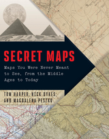
Is there anything more intriguing than a secret map? One that reveals clandestine information or meanings, or a map that is itself a secret? Secret Maps features over one hundred examples of these kinds of maps, connected by their varied relationships to secrecy, and ranging from the twelfth to the twenty-first centuries and across the globe. They include views into state secrecy and power—such as maps used for domestic and military purposes, imperial expansion, espionage, and surveillance as well as those with private or commercial uses, such as charts of private land, trade routes, or the flights of private jets. The maps span widely in their scope and cover issues of broad interest, from old-fashioned spying to contemporary concerns about technology and privacy.

As illuminating as it is thrilling, Secret Maps unearths the once-hidden routes, landscapes, and locations that have covertly shaped our world.

[more]


Send via email Share on Facebook Share on Twitter