
 A SCHOLARLY BOOK REPOSITORY
25 start with H start with H

Monique discovers that a portion of an ancient and deformed skeleton had also been stolen from the neglected museum archives. Her uncle, the spiritual leader Leroy Bear Red Ears, concludes that the stolen remains are those of Hatak haksi, a witch and the matriarch of the Crow family, a group of shape-shifting Choctaws who plan to reestablish themselves as the powerful creatures they were when the tribe lived in Mississippi. Monique, Leroy, and Chris must stop the Crows, but to their dread, the entities have retreated to the dark and treacherous hollow in the center of Chalakwa Ranch. The murderous shape-shifters believe the enormous wild hogs, poisonous snakes, and other creatures of the hollow might form an adequate defense for Hatak haksi.
But what no one counts on is the unexpected appearance and power of the Old Ones who guard the lands of the Choctaw afterlife. Blending tribal beliefs and myths into a modern context, The Hatak Witches continues the storyline of Choctaw cosmology and cultural survival that are prominent in Devon A. Mihesuah’s award-winning novel, The Roads of My Relations.
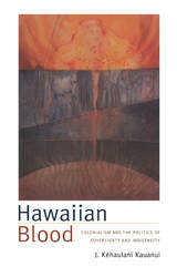
Kauanui provides an impassioned assessment of how the arbitrary correlation of ancestry and race imposed by the U.S. government on the indigenous people of Hawai‘i has had far-reaching legal and cultural effects. With the HHCA, the federal government explicitly limited the number of Hawaiians included in land provisions, and it recast Hawaiians’ land claims in terms of colonial welfare rather than collective entitlement. Moreover, the exclusionary logic of blood quantum has profoundly affected cultural definitions of indigeneity by undermining more inclusive Kanaka Maoli notions of kinship and belonging. Kauanui also addresses the ongoing significance of the 50-percent rule: Its criteria underlie recent court decisions that have subverted the Hawaiian sovereignty movement and brought to the fore charged questions about who counts as Hawaiian.

CONTENTS
The Reservation
Hard Riding
En roulant ma boule, roulant...
Meat for God
Snowfall
Train Time
Montana
The Hawk Is Hungry
Debt of Gratitude
Newcomers
Man's Work
Going to School
The City
Manhattan Wedlock
Let the War Be Fought
In the Alien Corn
Six Beautiful in Paris
The Silver Locket
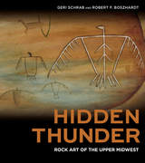
In Hidden Thunder, renowned watercolor artist Geri Schrab and archaeologist Robert "Ernie" Boszhardt give readers an up-close-and-personal look at rock art. With an eye toward preservation, Schrab and Boszhardt take you with them as they research, document, and interpret at the ancient petroglyphs and pictographs made my Native Americans in past millennia. In addition to publicly accessible sites such as Wisconsin’s Roche-a-Cri State Park and Minnesota’s Jeffers Petroglyphs, Hidden Thunder covers the artistic treasures found at several remote and inaccessible rock art sites—revealing the ancient stories through words, full-color photographs, and artistic renditions.
Offering the duo perspectives of scientist and artist, Boszhardt shares the facts that archaeologists have been able to establish about these important artifacts of our early history, while Schrab offers the artist's experience, describing her emotional and creative response upon encountering and painting these sites. Viewpoints by members of the Menominee, Ho-Chunk, Ojibwe, and other Native nations offer additional insight on the historic and cultural significance of these sites. Together these myriad voices reveal layers of meaning and cultural context that emphasize why these fragile resources—often marred by human graffiti and mishandling or damage from the elements—need to be preserved.
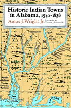
Identifies town site locations and clarifies entries from the earliest documents and maps of explorers in Alabama
This encyclopedic work is a listing of 398 ancient towns recorded within the present boundaries of the state of Alabama, containing basic information on each village's ethnic affiliation, time period, geographic location, descriptions, and (if any) movements. While publications dating back to 1901 have attempted to compile such a listing, none until now has so exhaustively harvested the 214 historic maps drawn between 1544, when Hernando de Soto's entourage first came through the southeastern territory, and 1846, when Indian removal to the Oklahoma Territory was complete. Wright combines the map data with a keen awareness of both previously published information and archival sources, such as colonial town lists, census information, and travel narratives.
The towns are listed alphabetically, and the text of each entry develops chronologically. While only a few of these towns have been accurately located by archaeologists, this volume provides a wealth of information for the future study of cultural geography, southeastern archaeology, and ethnohistory. It will be an enduring reference source for many years to come.
SAMPLE ENTRY,
ALIBAMA TOWN (Alibama)
The Alibama consisted of several towns—Mucclassa, Tawasa, Tomopa, Koarsati (Knight 1981, 27:48). Pickett ([1851] 1962:81) adds Ecanchati, Pawokti, and Autauga. The Alibama Town can also be added. Many maps show the Alibama as a group, but one map, 1796 Thomas and Andrews, locates the "Alabama Town"on the east bank of the Coosa just below Wetumpka.
Swanton ([1922] 1970a:209) wrote that the Tuskegee at the Alabama forks may have been known as the "Alabama Town"; however, this is unlikely, as Major W. Blue, a removal agent, wrote in July 1835 that Coosada, Alabama Town, and Tuskegee were ready to emigrate and they all lived adjoining each other in Macon County (ASP, Military Affairs 1861,6:731).
On 6 July 1838, some twenty-seven towns, including "Alibama" (NA M234 R225), attended the Creek council held in Indian Territory. Thomas Bibb, brother to Alabama territorial govenor William Wyatt Bibb, and others, including Nashville investors, founded the town of Alabama in 1817 at Ten Mile Bluff in Montgomery County (Moser 1980-94, 4:131). The town soon disappeared into history.
Treaties made in the 1800s between the United States and the Indigenous nations of what is now Wisconsin have had profound influence on the region’s cultural and political landscape. Yet few people realize that in the early part of that century, the Menominee and Ho-Chunk Nations of Wisconsin signed land treaties with several Indigenous nations from New York State. At the onset of the removal era, these eastern nations, including the Oneida Nation and the Six Nations Confederacy, were under constant pressure from the federal government and land speculators to move to lands around Green Bay and Lake Winnebago. In this groundbreaking book, Carol A. Cornelius has compiled a careful account of these nation-to-nation treaties, in large part in the words of those Indigenous leaders who served as the voices and representatives of their nations. Drawing on a rich collection of primary sources, Cornelius walks readers through how, why, and for whom these treaties were made and how the federal government’s failure and unwillingness to acknowledge their legitimacy led to the further loss of Indigenous lands. The living documents transcribed here testify to the complexity and sovereignty of Indigenous governance then and now, making this volume a vital resource for historians and an accessible introduction to Indigenous treatymaking in Wisconsin.
On the heels of the fiftieth anniversary of the founding of the Department of Diné Education, this important education history explains how the current Navajo educational system is a complex terrain of power relationships, competing agendas, and jurisdictional battles influenced by colonial pressures and tribal resistance. An iron grip of colonial domination over Navajo education remains, thus inhibiting a unified path toward educational sovereignty. In providing the historical roots to today’s challenges, Wendy Shelly Greyeyes clears the path and provides a go-to reference to move discussions forward.
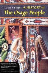
Traces 400 years of Osage culture from prehistoric times to the group's current status as an officially recognized tribe.
Osage traditional lands are located in mid-continental America encompassed by the present-day states of Arkansas, Missouri, Kansas, and Oklahoma. Major waterways through these lands and the defensible terrain of the Ozark range provided the tribe a distinct advantage in prehistoric and early historic times. A warlike people, the Osage long encroached on neighboring tribal lands, especially those of the Caddo to the southwest. Yet good natural boundaries and centuries of success in warfare afforded the tribe little advantage in attempts to forestall Euro-American westward expansion. Three major routes to the West—the Missouri and Arkansas Rivers and the Continental Trail—crossed Osage land, so conflict with the newcomers was inevitable.
Louis Burns draws on ancestral oral traditions and research in a broad body of literature to tell the story of the Osage people. He writes clearly and concisely, from the Osage perspective. First published in 1989 and for many years out of print, this revised edition is augmented by a new preface and maps. Because of its masterful compilation and synthesis of the known data, A History of the Osage People continues to be the best reference for information on an important American Indian people.
Louis F. Burns, of Osage-French-Scottish heritage, is a member of the Mottled Eagle Clan and author of six books, including Symbolic and Decorative Art of the Osage People.
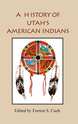
This book is a joint project of the Utah Division of Indian Affairs and the Utah State Historical Society. It is distributed to the book trade by Utah State University Press.
The valleys, mountains, and deserts of Utah have been home to native peoples for thousands of years. Like peoples around the word, Utah's native inhabitants organized themselves in family units, groups, bands, clans, and tribes. Today, six Indian tribes in Utah are recognized as official entities. They include the Northwestern Shoshone, the Goshutes, the Paiutes, the Utes, the White Mesa or Southern Utes, and the Navajos (Dineh). Each tribe has its own government. Tribe members are citizens of Utah and the United States; however, lines of distinction both within the tribes and with the greater society at large have not always been clear. Migration, interaction, war, trade, intermarriage, common threats, and challenges have made relationships and affiliations more fluid than might be expected. In this volume, the editor and authors endeavor to write the history of Utah's first residents from an Indian perspective. An introductory chapter provides an overview of Utah's American Indians and a concluding chapter summarizes the issues and concerns of contemporary Indians and their leaders. Chapters on each of the six tribes look at origin stories, religion, politics, education, folkways, family life, social activities, economic issues, and important events. They provide an introduction to the rich heritage of Utah's native peoples. This book includes chapters by David Begay, Dennis Defa, Clifford Duncan, Ronald Holt, Nancy Maryboy, Robert McPherson, Mae Parry, Gary Tom, and Mary Jane Yazzie.
Forrest Cuch was born and raised on the Uintah and Ouray Ute Indian Reservation in northeastern Utah. He graduated from Westminster College in 1973 with a bachelor of arts degree in behavioral sciences. He served as education director for the Ute Indian Tribe from 1973 to 1988. From 1988 to 1994 he was employed by the Wampanoag Tribe in Gay Head, Massachusetts, first as a planner and then as tribal administrator. Since October 1997 he has been director of the Utah Division of Indian Affairs.
Some are stories from oral traditions, others are autobiographical writings, and some are songs or poems. But all are contemporary, and all have as a unifying element a strong central theme in Native American writing: home places. Some of the contributors define the home place as a center of established values, while others speak of its cultural or physical geography. Healing powers are often found at home places. Home is a place to defend against those who would reduce it to insignificance, a place to reclaim, or a place reclaimed but not yet realized.
One writer recalls a home that must be pulled from deep beneath the waters of the Columbia River. By listening to these stories of home places, the reader can gain a new appreciation of the contemporary verbal expressions of Native American communities. Home Places, note the editors, "asks you to listen to Native American signers, storytellers, and writers, and in this way to celebrate the wellsprings of creativity that continue to flow from the home places in Native America."
Hope Leslie (1827), set in the seventeenth-century New England, is a novel that forced readers to confront the consequences of the Puritans’ subjugation and displacement of the indigenous Indian population at a time when contemporaries were demanding still more land from the Cherokees, the Chickasaws, and the Choctaws.
"This handsome reprint ... makes available after many decades the New Englander's tale of seventeeth-century Puritans, and their relations with the indigenous Indian population." -- Nineteeth-Century Literature
" A splendidly conceived edition of Sedwick's historical romance. Highly recommended." --Choice
"Develop(s) the connections between patriarchal authority within the Puritan state and its policy of dispossessing and exterminating Indians. The different heritage it envisions explicitly link white women and Indians and elaborates a communal concept of liberty at odds with the individualistic concept which predominated in American culture." -- Legacy

Rising dramatically from the desert floor, Arizona's windswept mesas have been home to the Hopis for hundreds of years. A people known for protecting their privacy, these Native Americans also have a long and less known tradition of weaving baskets and plaques. Generations of Hopi weavers have passed down knowledge of techniques and materials from the plant world around them, from mother to daughter, granddaughter, or niece.
This book is filled with photographs and detailed descriptions of their beautiful baskets—the one art, above all others, that creates the strongest social bonds in Hopi life. In these pages, weavers open their lives to the outside world as a means of sharing an art form especially demanding of time and talent. The reader learns how plant materials are gathered in canyons and creek bottoms, close to home and far away. The long, painstaking process of preparation and dying is followed step by step. Then, using techniques of coiled, plaited, or wicker basketry, the weaving begins.
Underlying the stories of baskets and their weavers is a rare glimpse of what is called "the Hopi Way," a life philosophy that has strengthened and sustained the Hopi people through centuries of change. Many other glimpses of the Hopi world are also shared by author and photographer Helga Teiwes, who was warmly invited into the homes of her collaborators. Their permission and the permission of the Cultural Preservation Office of the Hopi Tribe gave her access to people and information seldom available to outsiders.
Teiwes was also granted access to some of the ceremonial observances where baskets are preeminent. Woven in brilliant reds, greens, and yellows as well as black and white, Hopi weavings, then, not only are an arresting art form but also are highly symbolic of what is most important in Hopi life. In the women's basket dance, for example, woven plaques commemorate and honor the Earth and the perpetuation of life. Other plaques play a role in the complicated web of Hopi social obligation and reciprocity.
Living in a landscape of almost surreal form and color, Hopi weavers are carrying on one of the oldest arts traditions in the world. Their stories in Hopi Basket Weaving will appeal to collectors, artists and craftspeople, and anyone with an interest in Native American studies, especially Native American arts. For the traveler or general reader, the book is an invitation to enter a little-known world and to learn more about an art form steeped in meaning and stunning in its beauty.
All anthropologists and archaeologists seek to answer basic questions about human beings and society. Why do people behave the way they do? Why do patterns in the behavior of individuals and groups sometimes persist for remarkable periods of time? Why do patterns in behavior sometimes change?
A Hopi Social History explores these basic questions in a unique way. The discussion is constructed around a historically ordered series of case studies from a single sociocultural system (the Hopi) in order to understand better the multiplicity of processes at work in any sociocultural system through time. The case studies investigate the mysterious abandonments of the Western Pueblo region in late prehistory, the initial impact of European diseases on the Hopis, Hopi resistance to European domination between 1680 and 1880, the split of Oraibi village in 1906, and some responses by the Hopis to modernization in the twentieth century.
These case studies provide a forum in which the authors examine a number of theories and conceptions of culture to determine which theories are relevant to which kinds of persistence and change. With this broad theoretical synthesis, the book will be of interest to students and scholars in the social sciences.
Between the early seventeenth century and the early twentieth,nearly all the land in the United States was transferred from AmericanIndians to whites. This dramatic transformation has been understood in two very different ways--as a series of consensual transactions, but also as a process of violent conquest. Both views cannot be correct. How did Indians actually lose their land?
Stuart Banner provides the first comprehensive answer. He argues that neither simple coercion nor simple consent reflects the complicated legal history of land transfers. Instead, time, place, and the balance of power between Indians and settlers decided the outcome of land struggles. As whites' power grew, they were able to establish the legal institutions and the rules by which land transactions would be made and enforced.
This story of America's colonization remains a story of power, but a more complex kind of power than historians have acknowledged. It is a story in which military force was less important than the power to shape the legal framework within which land would be owned. As a result, white Americans--from eastern cities to the western frontiers--could believe they were buying land from the Indians the same way they bought land from one another. How the Indians Lost Their Land dramatically reveals how subtle changes in the law can determine the fate of a nation, and our understanding of the past.
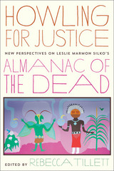
Howling for Justice actively engages with both the literary achievements and the politics of Silko’s text. It brings together essays by international scholars reacting to the novel while keeping in mind its larger concern with issues of social justice, both local and transnational. Aiming both to refocus critical attention and open the book to a broader array of readers, this collection offers fresh perspectives on its transnational vision, on its sociocultural, historical, and political ambitions, and on its continued relevance in the twenty-first century. The essays examine and explain some of the key points that readers and critics have identified as confusing, problematic, and divisive. Together, they offer new ways to approach and appreciate the text.
The book concludes with a new, never-before-published interview in which Silko reflects on the twenty years since the novel’s publication and relates the concerns of Almanac to her current work.
READERS
Browse our collection.
PUBLISHERS
See BiblioVault's publisher services.
STUDENT SERVICES
Files for college accessibility offices.
RECENTLY PUBLISHED


UChicago Accessibility Resources
home | accessibility | search | about | contact us
BiblioVault ® 2001 - 2024
The University of Chicago Press