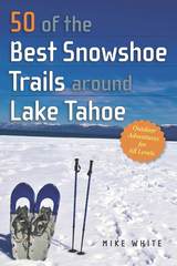
50 of the Best Snowshoe Trails Around Tahoe offers snowshoers of all levels and experience a wide-range of excursions—from flat and easy to steep and strenuous. It includes a wide range of snowshoe routes such as Mt. Rose, Carson Pass, Emerald Bay, Fallen Leaf Lake, Highway 89, Truckee and Donner Pass. Features include:
- Fifty distinct routes with directions to trailheads, detailed trip descriptions, and topographic maps
- Forty-five stunning photographs of popular trails, landscapes, and lake views
- Easy-to-read headings to provide key information on trail difficulty, distance, elevation, avalanche risk, facilities, managing agencies, highlights, lowlights, and more.
- A wide-range of outings for snowshoers of all abilities
- Recommendations on where to grab a hot drink, enjoy a hearty meal, or to snuggle up for a cozy overnight stay
- Tips on everything from proper clothing and footwear, equipment checklists, pre-hike warm-ups, sanitation, dog-friendly trails, and permit requirements
Whether you are an amateur explorer or a winter adventure enthusiast, this comprehensive guidebook has everything you need to explore the winter playgrounds surrounding Lake Tahoe.
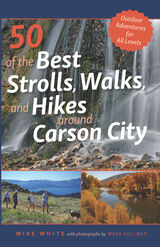
One of the area’s foremost experts on the outdoors, Mike White, author of 50 of the Best Strolls, Walks, and Hikes Around Reno, returns with a new guidebook dedicated to Carson City and its surrounding areas in northern Nevada. With over three hundred days of sunshine a year, this capital city’s parks, trails, lakes, and soaring peaks provide the perfect attractions for residents and visitors alike. This guide provides readers with the most precise information for a wide range of detailed paths and trails throughout the greater Carson City region and includes interesting sidebars about human and natural history for each trip.
From Virginia City and the Carson River on the east to the Sierra Nevada mountains to the west, this comprehensive guidebook offers the most complete guide for walkers, joggers, and hikers. Whether you are looking for a short and easy stroll on a city path or an extended hike along the Tahoe Rim Trail, this is your all-inclusive resource for your next outdoor adventure.

Taking the train to nature in Chicagoland
Beyond the steel and asphalt await natural spaces that are easy to access and balm for the soul. Lindsay Welbers’s guide tells readers how to use Chicagoland’s extensive public rail system to reach forests, prairies, wetlands, dunes, and Lake Michigan. Designed to take up minimal space in a backpack, Chicago Transit Hikes provides train-to-trailhead information for thirty nature treks with features that include:
- Chapters with hikes organized by each rail line on the Metra, the South Shore train, and the CTA;
- Information on everything from accessibility to dog-friendliness to flora and fauna;
- Detailed descriptions of every destination;
- Practical tips on packing lists and itineraries.
Up-to-date and user-friendly, Chicago Transit Hikes connects Chicagoans and visitors alike with excursions for every season and level of difficulty.

Few novelists have written so intimately about a city as Charles Dickens wrote about London, but he was intimately connected to Kent more than any other part of Britain. Perhaps Kent meant more to him than the capital. He had an idyllic childhood in Chatham and Kent features in his first works of fiction, Sketches by Boz and The Pickwick Papers, and in his favorite novel, David Copperfield. In his last ten years, he wrote two novels with strong Kentish themes, Great Expectations and The Mystery of Edwin Drood. He had his honeymoon outside Gravesend and often spent the summer months in Broadstairs. In 1856, he bought Gad’s Hill Place, near Rochester, and died there in 1870.
Dickens’s Kent begins with the description of a walk from London to Dickens's main residence, Gad’s Hill Place, before taking the reader to areas in Kent most closely associated with his life and work: the Medway Towns and their surroundings, Thanet and East Kent, and finally Staplehurst, the scene of the railway accident that nearly killed him.

In five walks through central London, Peter Clark explores “The First Suburbs”—Camden Town, Chelsea, Greenwich, Hampstead, Highgate and Limehouse—as they feature in Dickens’s writing and illuminates the settings of Dickens’s life and his greatest works of journalism and fiction. Describing these storied spaces of today’s central London in intimate detail, Clark invites us to experience the city as it was known to Dickens and his characters. These walks take us through the locations and buildings that he interacted with and wrote about, creating an imaginative reconstruction of the Dickensian world that has been lost to time.
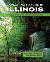
From the colorful variety of birds at War Bluff Valley Audubon Sanctuary to the exposed bedrock and cliff faces of Apple River Canyon, Exploring Nature in Illinois will inspire readers to explore wonders hidden from urban sprawl and cultivated farmland. Maps and descriptions help travelers access even hard-to-find sites while a wealth of detail and photography offers nature-lovers insights into the flora, fauna, and other aspects of vibrant settings and ecosystems. The authors also include diary entries describing their own impressions of and engagement with the sites.
A unique and much-needed reference, Exploring Nature in Illinois will entertain and enlighten hikers, cyclers, students and scouts, morning walkers, weekend drivers, and anyone else seeking to get back to nature in the Prairie State.

Chosen for the 2024 Illinois Reads Program by the Illinois Reading Council
One of Chicago’s landmark attractions, Graceland Cemetery chronicles the city’s sprawling history through the stories of its people. Local historian and Graceland tour guide Adam Selzer presents ten walking tours covering almost the entirety of the cemetery grounds. While nodding to famous Graceland figures from Marshall Field to Ernie Banks to Ludwig Mies van der Rohe, Selzer also leads readers past the vaults, obelisks, and other markers that call attention to less recognized Chicagoans like:
- Jessie Williams de Priest, the Black wife of a congressman whose 1929 invitation to a White House tea party set off a storm of controversy;
- Engineer and architect Fazlur Khan, the Bangladeshi American who revived the city's skyscraper culture;
- The still-mysterious Kate Warn (listed as Warn on her tombstone), the United States’ first female private detective.
Filled with photographs and including detailed maps of each tour route, Graceland Cemetery is an insider's guide to one of Chicago's great outdoor destinations for city lore and history.

Hidden San Francisco is a guidebook like no other. It’s a radical, alternative guidebook and history of San Francisco, complete with maps detailing walking and bike routes around the city.
San Francisco is an iconic and symbolic city. But only when you look beyond the picture-postcards of the Golden Gate Bridge and the quaint cable cars do you realize that the city's most interesting stories are not the Summer of Love, the Beats or even the latest gold rush in Silicon Valley.
Carlsson delves into the Bay Area's long prehistory, examining the region's geography and the lives of its inhabitants before the 1849 Gold Rush changed everything, setting in motion the clash between capital and labor that shaped the modern city. Structured around the four major themes of ecology, labor, transit and dissent, Chris Carlsson’s book peels back the layers of San Francisco's history to reveal a storied past: behind old walls and gleaming glass facades lurk former industries, secret music and poetry venues, forgotten terrorist bombings, and much more.
From the perspective of the students and secretaries, hippies and beatniks, longshoremen and waitresses, Hidden San Francisco uncovers dozens of overlooked, forgotten and buried histories that pulse through the streets and hills even today, inviting the reader to see themselves in the middle of the ongoing, everyday process of making history together.
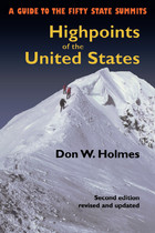
The highpoints of the fifty states range from Alaska’s 20,320 foot high Mount McKinley to 345 feet at Lakewood Park in Florida. Some highpoints, such as Mount Mitchell in North Carolina and New Hampshire’s Mount Washington can be reached by automobile on a sightseeing drive. Others such as Colorado’s Mount Elbert or Mount Marcy in New York are accessible as wilderness day hikes. Still others, such as Mount Rainier in Washington or Gannett Peak in Wyoming, are strenuous and risky mountaineering challenges that should be attempted only by experienced climbers. Whatever your level of skill and interest, Highpoints of the United States offers a diverse range of experiences.
Arranged alphabetically by state, each listing has a map, photographs, and information on trailhead, main and alternative routes, elevation gain, and conditions. Historical and natural history notes are also included, as are suggestions for specific guidebooks to a region or climb. Appendices include a list of highpoints by region, by elevation, and a personal log for the unashamed "peak-bagger."
Whether you’re an armchair hiker or a seasoned climber, interested only in your state’s highest point or all fifty, this book will be an invaluable companion and reference.
An invaluable resource to anyone traversing the Escalante, this comprehensive guide details 43 hikes.
Publisher's Note: Realizing there are virtually no marked trails in the Escalante country (mostly canyons that wander and have many intersections, challenging anyone to write explicit description), this book includes directions to the trailhead, how to follow a particular route with choices of side canyons along the way, and occasional alternate endings. Some of the hikes may be appropriate for beginners. Some only the most experienced should attempt.

Whether you have climbed these peaks many times, enjoy seeing them from your car window, or simply want to learn more about southwestern geology and history, reading Natural Landmarks of Arizona is a fascinating way to learn about the ancient and recent history of beloved places such as Cathedral Rock, Granite Dells, Kitt Peak, and many others. With Yetman as your guide, you can tuck this book into your glove box and hit the road with profound new knowledge about the towering natural monuments that define our beautiful Arizona landscapes.

Ponderosa is the first of its kind to provide an introduction to the natural and human histories of the ponderosa pine forests of the Southwest that is accessible to all who wish to enjoy the forests. The book offers knowledge on elemental aspects of the forests, such as the structure of the trees, as well as theoretical perspectives on issues such as climate change. Included are discussions of biogeography, ecology, and human and natural history, illustrated by over fifty color photographs throughout.
Allred presents his observations as if he is recalling his thoughts over the course of a walk in a ponderosa pine forest. His imagery-saturated prose provides an informal and enjoyable approach to discovering the history and environment of the ponderosa pine. Using a concise, straightforward writing style, Allred invites readers to explore the forests with him.
Ponderosa includes:
- More than 50 color photos
- Learn how to estimate the age of a tree
- See the reptiles, birds, and mammals that make their home in ponderosa pine forests
- Much more!
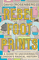
If you visit London, and you’ve only experienced Buckingham Palace, The Tower of London, and The Millennium Wheel, you’ve missed the true essence of London, and its politically-charged, rebellious history. A truly radical response to conservative heritage tours and banal day trips, Rebel Footprints brings to life the history of social movements in England's capital by providing lively commentary, maps, and walking tours you will not find anywhere else.
David Rosenberg transports readers from well-known landmarks to history-making hidden corners, while telling the story of protest and struggle in London from the early nineteenth to the mid-twentieth century.
From the suffragettes to the socialists, from the chartists to the trade unionists: Rosenberg invites us to step into the footprints of a diverse cast of dedicated fighters for social justice. Individual chapters highlight particular struggles and their participants, from famous faces to lesser-known luminaries. Chapters include:
*Writers and Rioters in the Fleet Street Precinct
*Trailblazers for Democracy in Clerkenwell Green
*The Spark of Rebellion in Bow
*Coming in from the Cold: Immigrant Agitators and Radicals in Spitalfields
*No Gods, No Masters: Radical Bloomsbury
*Life on the Boundary: Fighting for Housing in Bethnal Green and Shoreditch
*Stirrings from the South: The Battersea Four
*peaking Truth to Power: Suffragettes and Westminster
*Not Afraid of the Prison Walls: Rebel Women and Men of Poplar
*People's Power in Bermondsey
Rebel Footprints sets London's radical campaigners against the backdrop of the city's multi-faceted development. Self-directed walks pair with narratives that seamlessly blend history, politics, and geography, while specially commissioned maps and illustrations immerse the reader in the story of the city.
Whether you're visiting London for the first time, or born and raised there, Rosenberg invites you to see London as you never have before—the radical center of the English-speaking world.

Eastern Massachusetts offers incredible trail-running opportunities, ranging from popular long-distance routes like the Bay Circuit Trail to lesser-known loops that run through the mountains and forests of the Quabbin watershed and Merrimack Valley region, and trails that pass alongside the shores of Cape Cod. All over the Bay State, there are trails suitable for runners of all levels waiting to be discovered and explored.
Avid trail runner Ben Kimball offers a selection of fifty-one of eastern Massachusetts’s most spectacular trail sites, including detailed trail descriptions, topographic maps, directions, parking information, safety tips, and much more. Both experienced and novice trail runners will find Trail Running Eastern Massachusetts to be an invaluable resource for exploring nature and getting a good workout, in the Boston area and beyond.
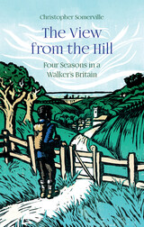
In Christopher Somerville’s workroom is a case of shelves that holds four hundred and fifty notebooks. Their pages are creased and stained with mud, blood, flattened insects, beer glass rings, smears of plant juice, and gallons of sweat. Everything Somerville has written about walking the British countryside has had its origin in these little black and red books.
During the lockdowns and enforced isolation of the COVID-19 pandemic, Somerville began to revisit this treasury of notes, spanning forty years of exploring on foot. The View from the Hill pulls together the best of his written collections, following the cycle of the seasons from a freezing January on the Severn Estuary to the sight of sunrise on Christmas morning from inside a prehistoric burial mound. In between are hundreds of walks to discover toads in a Cumbrian spring, trout in a Hampshire chalk stream, a lordly red stag at the autumn rut on the Isle of Mull, and three thousand geese at full gabble in the wintry Norfolk sky. Somerville’s writing enables readers to enjoy these magnificent walks without stirring from the comfort of home.
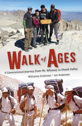
With hopes of being listed in the Guinness Book of World Records, Jim led the first documented walk from the highest to lowest point in the contiguous United States in 1974. He lived, albeit just barely, to tell the tale to his daughter, sparking a desire in Withanee to retrace his steps in his honor. In 2017, she took on the incredible task of recreating Jim’s legacy trek of 131 miles with the help of divine intervention, ice-cold beer, and her parents, who were following along as the support party.
Walk of Ages humorously relates the parallel journey of an epic adventure told from two perspectives—a daughter’s difficult quest, and a father who supports her through it while recalling his own experiences from four decades earlier. Throughout this momentous odyssey, readers will realize how a once-in-a-generation adventure leads to life-changing transformation, and that the bond between father and daughter knows no bounds.
When longtime author Robert Root moves to a small town in southeast Wisconsin, he gets to know his new home by walking the same terrain traveled by three Wisconsin luminaries who were deeply rooted in place—John Muir, Aldo Leopold, and August Derleth. Root walks with Muir at John Muir State Natural Area, with Leopold at the Shack, and with Derleth in Sac Prairie; closer to home, he traverses the Ice Age Trail, often guided by such figures as pioneering scientist Increase Lapham. Along the way, Root investigates the changes to the natural landscape over nearly two centuries, and he chronicles his own transition from someone on unfamiliar terrain to someone secure on his home ground.In prose that is at turns introspective and haunting, Walking Home Ground inspires us to see history’s echo all around us: the parking lot that once was forest; the city that once was glacier. "Perhaps this book is an invitation to walk home ground," Root tells us. "Perhaps, too, it’s a time capsule, a message in a bottle from someone given to looking over his shoulder even as he tries to examine the ground beneath his feet."

Samuel Pepys, the seventeenth century's best-known diarist, walked around London for miles, chronicling these walks in his diary. He made the two-and-a-half-mile trek to Whitehall from his house near the Tower of London on an almost daily basis. These streets, where many of his professional conversations took place while walking, became for him an alternative to his office.
With Walking Pepys’s London, we come to know life in London from the pavement up and see its streets from the perspective of this renowned diarist. The city was a key character in Pepys’s life, and this book draws parallels between his experience of seventeenth-century London and the lives of Londoners today. Bringing together geography, biography, and history, Jacky Colliss Harvey reconstructs the sensory and emotional experience of Pepys’s time. Full of fascinating details, Walking Pepys’s London is a sensitive exploration into the places that made the greatest English diarist of all time.
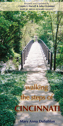
Walking the Steps of Cincinnati: A Guide to the Queen City’s Scenic and Historic Secrets is a revised and updated version of Mary Anna DuSablon’s original guidebook, first published in 1998. This new edition describes and maps thirty-four walks of varying lengths and levels of difficulty around the neighborhoods of Cincinnati, following scenic or historic routes and taking in many of the city’s more than four hundred sets of steps. Some of these walks follow the same routes laid out by DuSablon in the first edition of the guide; others have been revised to reflect changes in the city and its neighborhoods, the physical condition of the steps, and the scenic views of Cincinnati that they afford; and still others are altogether new.
In writing their descriptions of the walks, authors Connie J. Harrell and John Cicmanec have retraced each path and taken all new photographs of the steps as well as architectural and natural landmarks along the way. Cartographer Brian Balsley has drawn a fresh set of maps, and Roxanne Qualls, vice-mayor of Cincinnati, has graciously written a new foreword.
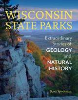
The impressive bluffs, valleys, waterfalls, and lakes of Wisconsin’s state parks provide more than beautiful scenery and recreational opportunities. They are windows into the distant past, offering clues to the dramatic events that have shaped the land over billions of years.
Author and former DNR journalist Scott Spoolman takes readers with him to twenty-eight parks, forests, and natural areas where evidence of the state’s striking geologic and natural history are on display. In an accessible storytelling style, Spoolman sheds light on the volcanoes that poured deep layers of lava rock over a vast area in the northwest, the glacial masses that flattened and molded the landscape of northern and eastern Wisconsin, mountain ranges that rose up and wore away over hundreds of millions of years, and many other bedrock-shaping phenomena. These stories connect geologic processes to the current landscape, as well as to the evolution of flora and fauna and development of human settlement and activities, for a deeper understanding of our state’s natural history.
The book includes a selection of detailed trail guides for each park, which hikers can take with them on the trail to view evidence of Wisconsin’s geologic and natural history for themselves.
READERS
Browse our collection.
PUBLISHERS
See BiblioVault's publisher services.
STUDENT SERVICES
Files for college accessibility offices.
UChicago Accessibility Resources
home | accessibility | search | about | contact us
BiblioVault ® 2001 - 2025
The University of Chicago Press


