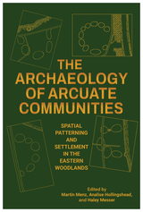
The varied case studies in this volume focus on specific communities, how they evolved, and the types of archaeological data that have been used to assess them. Part I, “Defining the Domestic Unit in Arcuate Communities,” reveals social distinctions between households and household clusters in arcuate communities, how they differ in terms of stylistic patterns and exchange, and how they combined to form distinct social groups at different scales within a broader community. Part II, “Organizing Principles of Arcuate Communities,” broadens the scope to identify the organizing principles of entire arcuate communities, such as the central role of plazas in structuring their development, how the distribution of households and central features within communities was contested and reorganized, and the importance of mounds in both delineating arcuate communities and marking their position on the landscape. Part III, “Comparison and Change in Arcuate Communities,” comprises case studies that examine changes in the organization of arcuate communities over time. Rounding out the volume is a concluding chapter that assesses how and why communities around the world formed in circular patterns.
A valuable resource for archaeologists, this collection will also be of interest to those seeking to learn about Native North American settlement, ceremony, and community organization.

Beliefs and Rituals in Archaic Eastern North America describes, illustrates, and offers nondogmatic interpretations of rituals and beliefs in Archaic America. In compiling a wealth of detailed entries, author Cheryl Claassen has created both an exhaustive reference as well as an opening into new archaeological taxonomies, connections, and understandings of Native American culture.
The material is presented in an introductory essay about Archaic rituals followed by two sections of entries that incorporate reports and articles discussing archaeological sites; studies of relevant practices of ritual and belief; data related to geologic features, artifact attributes, and burial settings; ethnographies; and pilgrimages to specific sites. Claassen’s work focuses on the American Archaic period (marked by the end of the Ice Age approximately 11,000 years ago) and a geographic area bounded by the edge of the Great Plains, Newfoundland, and southern Florida. This period and region share specific beliefs and practices such as human sacrifice, dirt mound burial, and oyster shell middens.
This interpretive guide serves as a platform for new interpretations and theories on this period. For example, Claassen connects rituals to topographic features and posits the Pleistocene-Holocene transition as a major stimulus to Archaic beliefs. She also expands the interpretation of existing data previously understood in economic or environmental terms to include how this same data may also reveal spiritual and symbolic practices. Similarly, Claassen interprets Archaic culture in terms of human agency and social constraint, bringing ritual acts into focus as drivers of social transformation and ethnogenesis.
Richly annotated and cross-referenced for ease of use, Beliefs and Rituals in Archaic Eastern North America will benefit scholars and students of archaeology and Native American culture. Claassen’s overview of the archaeological record should encourage the development of original archaeological and historical connections and patterns. Such an approach, Claassen suggests, may reveal patterns of influence extending from early eastern Americans to the Aztec and Maya.

Why indigenous plants, you may ask? What makes them so special to butterflies and bees and boys and girls? For Carolyn Summers, the answer is as natural as an ephemeral spring wildflower or berries of the gray dogwood, "As I studied indigenous plants, a strange thing happened. The plants grew on me. I began to love the plants themselves for their own unique qualities, quite apart from their usefulness in providing food and shelter for wildlife.
Emphasizing the importance of indigenous plant gardening and landscape design, Summers provides guidelines for skilled sowers and budding bloomers. She highlights . . .
- The best ways to use exotic and non-indigenous plants responsibly
- Easy-to-follow strategies for hosting wildlife in fields, forests, and gardens
- Designs for traditional gardens using native trees, shrubs, groundcovers as substitutes for exotic plants
- Examples of flourishing plant communities from freshwater streams to open meadows
- How to control plant reproduction, choose cultivars, open-pollinated indigenous plants, and different types of hybrids, and practice “safe sex in the garden

In this fully revised second edition of the classic guide Designing Gardens with Flora of the American East, gardening expert Carolyn Summers draws on the most recent research on sustainable landscaping. She is joined in this edition by her daughter, landscape designer Kate Brittenham, offering an intergenerational dialogue about the importance of using indigenous plants that preserve insect and bird habitats. The practical information they provide is equally useful for home gardeners and professionals, including detailed descriptions of keystone trees, shrubs, perennials, vines, and grasses that are native to the eastern United States. Accompanied by entirely new illustrations and updated plant lists, they offer chic yet eco-friendly landscape designs fully customized for different settings, from suburban yards to corporate office parks.
The states covered in this book are CT, DE, IA, IL, IN, KY, MA, MD, ME, MI, MN, MO, NC, NH, NJ, NY, OH, PA, RI, TN, VA, VT, WI, and WV, as well as southern Quebec and Ontario.
Eastern Old-Growth Forests is the first book devoted exclusively to old growth throughout the East. Authoritative essays from leading experts examine the ecology and characteristics of eastern old growth, explore its history and value -- both ecological and cultural -- and make recommendations for its preservation.
The book provides a thorough overview of the importance of old growth in the East including its extent, qualities, and role in wildlands restoration. It will serve a vital role in furthering preservation efforts by making eastern old-growth issues better known and understood.
Forest ecologists William Keeton and Andrew Barton bring together a volume that breaks new ground in our understanding of ecological systems and their importance for forest resilience in an age of rapid environmental change. This edited volume covers a broad geographic canvas, from eastern Canada and the Upper Great Lakes states to the deep South. It looks at a wide diversity of ecosystems, including spruce-fir, northern deciduous, southern Appalachian deciduous, southern swamp hardwoods, and longleaf pine. Chapters authored by leading old-growth experts examine topics of contemporary forest ecology including forest structure and dynamics, below-ground soil processes, biological diversity, differences between historical and modern forests, carbon and climate change mitigation, management of old growth, and more.
This thoughtful treatise broadly communicates important new discoveries to scientists, land managers, and students and breathes fresh life into the hope for sensible, effective management of old-growth stands in eastern forests.

The book begins by looking at destructive practices widely used by the timber industry in the late 1800s and early 1900s, including extensive clearcutting followed by forest fire that devastated entire landscapes. The authors explain how this led to the birth of a new conservation movement that began simultaneously in the Southern Appalachians and New England, and describe the subsequent protection of forests in New England (New Hampshire and the White Mountains); the Great Lakes region (Michigan, Wisconsin, and Minnesota), and the Southern Appalachians.
Following this historical background, the authors offer eight case studies that examine critical issues facing the eastern national forests today, including timber harvesting, the use of fire, wilderness protection, endangered wildlife, oil shale drilling, invasive species, and development surrounding national park borders.
Forests for the People is the only book to fully describe the history of the Weeks Act and the creation of the eastern national forests and to use case studies to illustrate current management issues facing these treasured landscapes. It is an important new work for anyone interested in the past or future of forests and forestry in the United States.
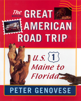
Take an unforgettable road trip down one of America’s most fascinating highways, U.S.
On what highway can you find the headquarters of the FBI, Dow Jones Interactive, and the National Enquirer? What road is home to the Bronx Zoo, the Okefenokee Swamp, and Flipper? On the side of what freeway can you find the Super Duper Weenie Wagon, Larry’s Redneck Bar, and the Big Chicken Barn? Peter Genovese found them all, along with about a million other fascinating and bizarre attractions, on U.S. 1, ‘the best damn highway in America,” as he calls it. Join him for the road trip of a lifetime The Great American Road Trip: A Journey Down U.S. 1.
U.S. 1 may not be America’s scenic highway, but it’s certainly the most colorful. It runs through Boston, New York, Baltimore, Washington, D.C., and Miami, in addition to Caribou, Maine, Quonochontaug, Rhode Island, and Alma, Georgia. It zig-zags along the wild and beautiful Maine coast and soars over the Atlantic Ocean as the Overseas Highway, one of the most spectacular stretches of road anywhere. The Star-Spangled Banner is on U.S. 1. Madonna lived on U.S. 1 (until she sold her house to Rosie O'Donnell). U.S. 1 is Main Street and the Miracle Mile, two-lane blacktop and six-lane expressway, straight as an arrow in some places and twistier than a Philadelphia soft pretzel in others.
Genovese spent two years on U.S. 1, talking to everyone from doughnut makers, dolphin trainers, and swamp guides to real Miami vice cops and the keeper of the national parasite collection. His resulting book is the most complete portrait of an American highway ever written. With his unerring eye for detail, sense of humor, and understanding of human nature, Genovese takes readers on a sometimes funny, sometimes sad, always illuminating 2,450-mile journey from Fort Kent, Maine to Key West, Florida.
Ride along with Genovese and grab a drink at the Last Resort Bar or the Last Chance Saloon, then pick up a paperback at the Banned Bookstore. Visit Oscar, the biggest gator in the Okefenokee Swamp, have dinner at Hog Heaven, and take in a Portland Seadogs baseball game. Tour a Budweiser brewery and go into the pit at a NASCAR race. Looking for someplace to stay? How about the world’s only underwater hotel, the Jules’ Undersea Lodge, or in a cabin made entirely from one pine tree at the Maine Idyll Motor Court? If it’s culture you seek, the highway boasts dozens of museums. While you may have heard of the Museum of Natural History and the National Museum of American Art, how about the Blacks in Wax Museum, Tragedy in the United States Museum, and the Mushroom Museum? There’s something for everyone on U.S. 1, and Genovese has written about it all in The Great American Road Trip.
Eastern North America has one of the largest inventories of Paleoindian sites anywhere in the Americas. Despite this rich record of early human settlement during the late Pleistocene, there are few widely published reports or summaries of Paleoindian research in the region. The contributors to this volume present more than four decades of Early Paleoindian research in eastern North America, including previously unpublished site reports and updates on recent research. Their work helps create a more cohesive picture of the early human occupation of North America.
This data-rich volume provides specific information on artifacts and basic site descriptions which will allow for more thorough comparisons of eastern fluted point sites. Divided into four sections—chronology and environment, reinvestigations of classic sites, new sites and perspectives, and synthesis and conclusions—the volume will encourage further consideration of the sites included and their role in shaping our understanding of huntergatherer lifeways during the late Pleistocene. In the Eastern Fluted Point Tradition is a must read for scholars of Paleoindian archaeology and those generally interested in the prehistory of North America.
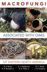
Macrofungi Associated with Oaks of Eastern North America, which was written as a companion to Field Guide to Oak Species of Eastern North America, represents the first major publication devoted exclusively to the macrofungi that occur in association with oak trees in the forests of eastern North America. The macrofungi covered in this volume include many of the more common examples of the three groups—mycorrhizal fungi, decomposers, and pathogens—that are ecologically important to the forest ecosystems in which oaks occur. More than 200 species of macrofungi are described and illustrated via vibrantly colored photographs. Information is given on edibility, medicinal properties, and other novel uses as well. This publication reflects the combined expertise of six mycologists on the macrofungi anyone would be likely to encounter in an oak forest.

“Never before has the case been more compellingly made that America’s dependence on a free and abundant water supply has become an illusion. Cynthia Barnett does it by telling us the stories of the amazing personalities behind our water wars, the stunning contradictions that allow the wettest state to have the most watered lawns, and the thorough research that makes her conclusions inescapable. Barnett has established herself as one of Florida’s best journalists and Mirage is a must-read for anyone who cares about the future of the state.”
—Mary Ellen Klas, Capital Bureau Chief, Miami Herald
“Mirage is the finest general study to date of the freshwater-supply crisis in Florida. Well-meaning villains abound in Cynthia Barnett’s story, but so too do heroes, such as Arthur R. Marshall Jr., Nathaniel Reed, and Marjorie Harris Carr. The author’s research is as thorough as her prose is graceful. Drinking water is the new oil. Get used to it.”
—Michael Gannon, Distinguished Professor of history, University of Florida, and author of Florida: A Short History
“With lively prose and a journalist’s eye for a good story, Cynthia Barnett offers a sobering account of water scarcity problems facing Florida—one of our wettest states—and the rest of the East Coast. Drawing on lessons learned from the American West, Mirage uses the lens of cultural attitudes about water use and misuse to plead for reform. Sure to engage and fascinate as it informs.”
—Robert Glennon, Morris K. Udall Professor of Law and Public Policy, University of Arizona, and author of Water Follies: Groundwater Pumping and the Fate of America’s Fresh Waters
Part investigative journalism, part environmental history, Mirage reveals how the eastern half of the nation—historically so wet that early settlers predicted it would never even need irrigation—has squandered so much of its abundant freshwater that it now faces shortages and conflicts once unique to the arid West.
Florida’s parched swamps and supersized residential developments set the stage in the first book to call attention to the steady disappearance of freshwater in the American East, from water-diversion threats in the Great Lakes to tapped-out freshwater aquifers along the Atlantic seaboard.
Told through a colorful cast of characters including Walt Disney, Jeb Bush and Texas oilman Boone Pickens, Mirage ferries the reader through the key water-supply issues facing America and the globe: water wars, the politics of development, inequities in the price of water, the bottled-water industry, privatization, and new-water-supply schemes.
From its calamitous opening scene of a sinkhole swallowing a house in Florida to its concluding meditation on the relationship between water and the American character, Mirage is a compelling and timely portrait of the use and abuse of freshwater in an era of rapidly vanishing natural resources.
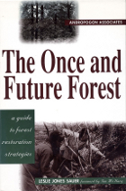
Developed by the pioneering landscape design firm of Andropogon Associates, world-renowned for their innovative approach to integrating environmental protection and restoration with landscape architecture and design, The Once and Future Forest is a guidebook for restoring and managing natural landscapes. Focusing on remnant forest systems, it describes methods of restoring and linking forest fragments to recreate a whole landscape fabric.
The book begins by explaining the history and current situation of forest ecosystems in the eastern United States. Following that is an in-depth examination of the restoration process, with thorough descriptions of ecological strategies for landscape management along with specific examples of how those strategies have been implemented in various sites around the country. The final section provides hands-on information about the many specific details that must be considered when initiating and implementing a restoration program. All aspects of the restoration process are considered, including: Water -- opportunities for increasing infiltration, reducing pollutants, promoting habitat values Ground -- methods of protecting existing vegetation, removing fill, rebuilding soils Plants -- strategies and procedures for planting, maintenance, propagation Wildlife -- guidelines for preserving wildlife resources, management techniques to favor selected specie.
The Once and Future Forest presents a comprehensive approach to assessing sites, detailed guidelines for determining management goals, and a thorough overview of appropriate management and restoration techniques. It is an important guide for professional planners and landscape architects, government agency personnel at all levels, land managers, scientists involved in restoration work, and citizen activists who wish to do something constructive about our deteriorating forest patches.
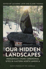
This volume introduces readers to eastern North America’s Indigenous ceremonial stone landscapes (CSLs)—sacred sites whose principal identifying characteristics are built stone structures that cluster within specific physical landscapes. Our Hidden Landscapes presents these often unrecognized sites as significant cultural landscapes in need of protection and preservation.
In this book, Native American authors provide perspectives on the cultural meaning and significance of CSLs and their characteristics, while professional archaeologists and anthropologists provide a variety of approaches for better understanding, protecting, and preserving them. The chapters present overwhelming evidence in the form of oral tradition, historic documentation, ethnographies, and archaeological research that these important sites created and used by Indigenous peoples are deserving of protection.
This work enables archaeologists, historians, conservationists, foresters, and members of the general public to recognize these important ritual sites.
Contributors
Nohham Rolf Cachat-Schilling
Robert DeFosses
James Gage
Mary Gage
Doug Harris
Julia A. King
Lucianne Lavin
Johannes (Jannie) H. N. Loubser
Frederick W. Martin
Norman Muller
Charity Moore Norton
Paul A. Robinson
Laurie W. Rush
Scott M. Strickland
Elaine Thomas
Kathleen Patricia Thrane
Matthew Victor Weiss

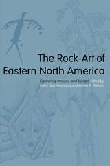
Showcases the wealth of new research on sacred imagery found in twelve states and four Canadian provinces
In archaeology, rock-art—any long-lasting marking made on a natural surface—is similar to material culture (pottery and tools) because it provides a record of human activity and ideology at that site. Petroglyphs, pictographs, and dendroglyphs (tree carvings) have been discovered and recorded throughout the eastern woodlands of North America on boulders, bluffs, and trees, in caves and in rock shelters. These cultural remnants scattered on the landscape can tell us much about the belief systems of the inhabitants that left them behind.
The Rock-Art of Eastern North America brings together 20 papers from recent research at sites in eastern North America, where humidity and the actions of weather, including acid rain, can be very damaging over time. Contributors to this volume range from professional archaeologists and art historians to avocational archaeologists, including a surgeon, a lawyer, two photographers, and an aerospace engineer. They present information, drawings, and photographs of sites ranging from the Seven Sacred Stones in Iowa to the Bald Friar Petroglyphs of Maryland and from the Lincoln Rise Site in Tennessee to the Nisula Site in Quebec.
Discussions of the significance of artist gender, the relationship of rock-art to mortuary caves, and the suggestive link to the peopling of the continent are particularly notable contributions. Discussions include the history, ethnography, recording methods, dating, and analysis of the subject sites and integrate these with the known archaeological data.

Archaeologists today are interpreting Native American religion and ritual in the distant past in more sophisticated ways, considering new understandings of the ways that Native Americans themselves experienced them. Shaman, Priest, Practice, Belief: Materials of Ritual and Religion in Eastern North America broadly considers Native American religion and ritual in eastern North America and focuses on practices that altered and used a vast array of material items as well as how physical spaces were shaped by religious practices.
Unbound to a single theoretical perspective of religion, contributors approach ritual and religion in diverse ways. Importantly, they focus on how people in the past practiced religion by altering and using a vast array of material items, from smoking pipes, ceremonial vessels, carved figurines, and iconographic images, to sacred bundles, hallucinogenic plants, revered animals, and ritual architecture. Contributors also show how physical spaces were shaped by religious practice, and how rock art, monuments, soils and special substances, and even land- and cityscapes were part of the active material worlds of religious agents.
Case studies, arranged chronologically, cover time periods ranging from the Paleoindian period (13,000–7900 BC) to the late Mississippian and into the protohistoric/contact periods. The geographical scope is much of the greater southeastern and southern Midwestern culture areas of the Eastern Woodlands, from the Central and Lower Mississippi River Valleys to the Ohio Hopewell region, and from the greater Ohio River Valley down through the Deep South and across to the Carolinas.
Contributors
Sarah E. Baires / Melissa R. Baltus / Casey R. Barrier / James F. Bates / Sierra M. Bow / James A. Brown / Stephen B. Carmody / Meagan E. Dennison / Aaron Deter-Wolf / David H. Dye / Bretton T. Giles / Cameron Gokee / Kandace D. Hollenbach / Thomas A. Jennings / Megan C. Kassabaum / John E. Kelly / Ashley A. Peles / Tanya M. Peres / Charlotte D. Pevny / Connie M. Randall / Jan F. Simek / Ashley M. Smallwood / Renee B. Walker / Alice P. Wright
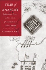
A gripping account of the violence and turmoil that engulfed England’s fledgling colonies and the crucial role played by Native Americans in determining the future of North America.
In 1675, eastern North America descended into chaos. Virginia exploded into civil war, as rebel colonists decried the corruption of planter oligarchs and massacred allied Indians. Maryland colonists, gripped by fears that Catholics were conspiring with enemy Indians, rose up against their rulers. Separatist movements and ethnic riots swept through New York and New Jersey. Dissidents in northern Carolina launched a revolution, proclaiming themselves independent of any authority but their own. English America teetered on the edge of anarchy.
Though seemingly distinct, these conflicts were in fact connected through the Susquehannock Indians, a once-mighty nation reduced to a small remnant. Forced to scatter by colonial militia, Susquehannock bands called upon connections with Indigenous nations from the Great Lakes to the Deep South, mobilizing sources of power that colonists could barely perceive, much less understand. Although the Susquehannock nation seemed weak and divided, it exercised influence wildly disproportionate to its size, often tipping settler societies into chaos. Colonial anarchy was intertwined with Indigenous power.
Piecing together Susquehannock strategies from a wide range of archival documents and material evidence, Matthew Kruer shows how one people’s struggle for survival and renewal changed the shape of eastern North America. Susquehannock actions rocked the foundations of the fledging English territories, forcing colonial societies and governments to respond. Time of Anarchy recasts our understanding of the late seventeenth century and places Indigenous power at the heart of the story.
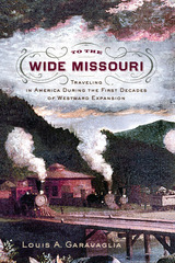
The Fascinating History of the Rapid Expansion of Roads, Canals, and Railways in the First Decades of the United States
While the great overland migration routes to America’s far west are well known and documented—the California, Oregon, Mormon, and Santa Fe Trails, the Central Overland and Pony Express—less attention has been given to how Americans in the first decades of the republic traveled across the western frontiers of the original colonies. Following the revolution, Americans began to seek their fortunes to the west in greater numbers. Land grants to veterans inspired others to move, including tradesmen, merchants, and tavern owners. With the Louisiana Purchase in 1803, the country doubled in size, and the rate of migration became extraordinary, with wider and more durable roads built, ferries installed at river crossings, canals cut to move goods, regular stage routes established, and ultimately the first railroad tracks laid down. Entire regions that supported few communities in the 1790s exploded in population, and as a result seven new states were admitted to the Union in the decade following the War of 1812. John Bradbury, who traveled through the United States between 1809 and 1811, wrote that “In passing through the upper parts of Virginia, I observed a great number of farms that had been abandoned, on many of which good houses had been erected, and fine apple and peach orchards had been planted. On enquiring the reason, I was always informed that the owners had gone to the western country.” In Maryland, a newspaper reporter wrote, “The time is close at hand when the region west of the Allegheny mountains will sway the destinies of the nation.” By 1839, the National Road extended more than 700 miles from Washington, DC, to central Illinois, New York’s Erie Canal operated from Albany to Buffalo, and the Baltimore and Ohio Railroad carried passengers briskly west, ultimately to the Ohio River.
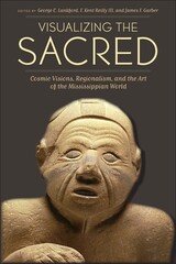
The prehistoric native peoples of the Mississippi River Valley and other areas of the Eastern Woodlands of the United States shared a complex set of symbols and motifs that constituted one of the greatest artistic traditions of the pre-Columbian Americas. Traditionally known as the Southeastern Ceremonial Complex, these artifacts of copper, shell, stone, clay, and wood were the subject of the groundbreaking 2007 book Ancient Objects and Sacred Realms: Interpretations of Mississippian Iconography, which presented a major reconstruction of the rituals, cosmology, ideology, and political structures of the Mississippian peoples.
Visualizing the Sacred advances the study of Mississippian iconography by delving into the regional variations within what is now known as the Mississippian Iconographic Interaction Sphere (MIIS). Bringing archaeological, ethnographic, ethnohistoric, and iconographic perspectives to the analysis of Mississippian art, contributors from several disciplines discuss variations in symbols and motifs among major sites and regions across a wide span of time and also consider what visual symbols reveal about elite status in diverse political environments. These findings represent the first formal identification of style regions within the Mississippian Iconographic Interaction Sphere and call for a new understanding of the MIIS as a network of localized, yet interrelated religious systems that experienced both continuity and change over time.
READERS
Browse our collection.
PUBLISHERS
See BiblioVault's publisher services.
STUDENT SERVICES
Files for college accessibility offices.
UChicago Accessibility Resources
home | accessibility | search | about | contact us
BiblioVault ® 2001 - 2025
The University of Chicago Press


