front cover of The Averaged American
The Averaged American
Surveys, Citizens, and the Making of a Mass Public
Sarah E. Igo
Harvard University Press, 2007

Americans today “know” that a majority of the population supports the death penalty, that half of all marriages end in divorce, and that four out of five prefer a particular brand of toothpaste. Through statistics like these, we feel that we understand our fellow citizens. But remarkably, such data—now woven into our social fabric—became common currency only in the last century. Sarah Igo tells the story, for the first time, of how opinion polls, man-in-the-street interviews, sex surveys, community studies, and consumer research transformed the United States public.

Igo argues that modern surveys, from the Middletown studies to the Gallup Poll and the Kinsey Reports, projected new visions of the nation: authoritative accounts of majorities and minorities, the mainstream and the marginal. They also infiltrated the lives of those who opened their doors to pollsters, or measured their habits and beliefs against statistics culled from strangers. Survey data underwrote categories as abstract as “the average American” and as intimate as the sexual self.

With a bold and sophisticated analysis, Igo demonstrates the power of scientific surveys to shape Americans’ sense of themselves as individuals, members of communities, and citizens of a nation. Tracing how ordinary people argued about and adapted to a public awash in aggregate data, she reveals how survey techniques and findings became the vocabulary of mass society—and essential to understanding who we, as modern Americans, think we are.

[more]

front cover of Designing for Diversity
Designing for Diversity
Gender, Race, and Ethnicity in the Architectural Profession
Kathryn H. Anthony
University of Illinois Press, 2000

A powerful statement about the repercussions of discrimination and the benefits of diversity in architecture

Providing hard data for trends that many perceive only vaguely and some deny altogether, Designing for Diversity reveals a profession rife with gender and racial discrimination and examines the aspects of architectural practice that hinder or support the full participation of women and persons of color.
Drawing on interviews and surveys of hundreds of architects, Kathryn H. Anthony outlines some of the forms of discrimination that recur most frequently in architecture: being offered added responsibility without a commensurate rise in position, salary, or credit; not being allowed to engage in client contact, field experience, or construction supervision; and being confined to certain kinds of positions, typically interior design for women, government work for African Americans, and computer-aided design for Asian American architects.

Anthony discusses the profession's attitude toward flexible schedules, part-time contracts, and the demands of family and identifies strategies that have helped underrepresented individuals advance in the profession, especially establishing a strong relationship with a mentor. She also observes a strong tendency for underrepresented architects to leave mainstream practice, either establishing their own firms, going into government or corporate work, or abandoning the field altogether.

Given the traditional mismatch between diverse consumers and predominantly white male producers of the built environment, plus the shifting population balance toward communities of color, Anthony contends that the architectural profession staves off true diversity at its own peril. Designing for Diversity argues convincingly that improving the climate for nontraditional architects will do much to strengthen architecture as a profession. Practicing architects, managers of firms, and educators will learn how to create conditions more welcoming to a diversity of users as well as designers of the built environment.

[more]

front cover of Early Indiana Trails and Surveys
Early Indiana Trails and Surveys
George R. Wilson
Indiana Historical Society Press, 1986

front cover of Grand Canyon, A Century of Change
Grand Canyon, A Century of Change
Rephotography of the 1889-1890 Stanton Expedition
Robert H. Webb
University of Arizona Press, 1996
Photographs made in Grand Canyon a century ago may provide us today with a sense of history; photographs made a century later from the same vantage points give us a more precise picture of change in this seemingly timeless place. Between 1889 and 1890, Robert Brewster Stanton made photographs every 1-2 miles through the river corridor for the purpose of planning a water-level railroad route and produced the largest collection of photographs of the Colorado River at one point in time. Robert Webb, a USGS hydrologist conducting research on debris flows in the Canyon, obtained the photographs and from 1989 to 1995 replicated all 445 of the views captured by Stanton, matching as closely as possible the original camera positions and lighting conditions. Grand Canyon, a Century of Change assembles the most dramatic of these paired photographs to demonstrate both the persistence of nature and the presence of humanity. Unexpected longevity of some plant species, effects of animal grazing, and expansion of cacti are all captured by the replicate photographs. More telling is evidence of the impact of Glen Canyon Dam: increased riparian vegetation, new marshes, aggraded debris fans, and eroded sand bars. In the accompanying text, Webb provides a thorough analysis of what each pair of photographs shows and places the project in its historical context. Complementing his narrative are six sidebar articles by authorities on Canyon natural history that further attest to a century of change. The level of detail obtained from the photographs represents one of the most extensive long-term monitoring efforts ever conducted in a national park; it is the most detailed documentation effort ever performed using repeat photography. Much more than simply a picture book, Grand Canyon, a Century of Change is an environmental history of the river corridor, a fascinating book that clearly shows the impact of human influence on Grand Canyon and warns us that its future is very much in our hands.
[more]

front cover of Old Deseret Live Stock Company
Old Deseret Live Stock Company
A Stockman's Memoir
W. Dean Frischknecht
Utah State University Press, 2008

In the high country of the northern Wasatch Mountains, lies what is left of one of the West’s largest ranches. Deseret Live Stock Company was reputed at various times to be the largest private landholder in Utah and the single biggest producer of wool in the world. The ranch began as a sheep operation, but as it found success, it also ran cattle. Incorporated in the 1890s by a number of northern Utah ranchers who pooled their resources, the company was at the height of successful operations in the mid-twentieth century when a young Dean Frischknecht, bearing a recent degree in animal science, landed the job of sheep foreman. In his memoir he recounts in detail how Deseret managed huge herds of livestock, vast lands, and rich wildlife and recalls through lively anecdotes how stockmen and their families lived and worked in the Wasatch Mountains and Skull Valley’s desert wintering grounds.

[more]

front cover of Peter Fidler
Peter Fidler
From York Factory to the Rocky Mountains
Barbara Belyea
University Press of Colorado, 2020
In 1792–93 Peter Fidler surveyed the Hudson’s Bay Company’s river and overland routes west from York Factory. He traveled with a fur brigade up the Hayes and Saskatchewan Rivers and then spent the winter months with a Piikani band who hunted buffalo in the Rocky Mountain foothills. Fidler kept precise journals that make it possible to follow the traders’ passage over a lake-strewn landscape and across the plains. The journal texts combine astronomical observations, notation of distances and directions, small sketch maps, and verbal descriptions. Peter Fidler: From York Factory to the Rocky Mountains presents two of Fidler’s survey journals edited and extensively annotated by historian Barbara Belyea from manuscripts in the Hudson’s Bay Company Archives.
 
The two journals—“From York Factory to Buckingham House” and “From Buckingham House to the Rocky Mountains”—detail Fidler’s travels over a period of nine months. They include remarks on fur trade history, organization of the inland brigade, three distinct geographical regions, and the daily life of a Plains nation. Belyea’s introduction and ample notes provide insight into the way geographic, specifically cartographic, information was noted in the journals, with additional information on industry trading techniques, traders’ economic decisions, broad changes in regional social and economic conditions, and interactions with indigenous peoples.
 
Fidler’s journals are an exceptional record of the fur trade’s western expansion and the daily life of a Plains nation at the height of its power and prosperity. With its rich analysis of primary source documents and painstaking reproduction of historical trade routes, Peter Fidler: From York Factory to the Rocky Mountains will be of great value to students and scholars in the fields of fur trade studies, cartography, travel literature, and Canadian history, as well as general readers interested in westward expansion, exploration, commerce, and indigenous-colonial relations.
 
[more]

front cover of Questions About Questions
Questions About Questions
Inquiries into the Cognitive Bases of Surveys
Judith M. Tanur
Russell Sage Foundation, 1992
The social survey has become an essential tool in modern society, providing crucial measurements of social change, describing social life, and guiding government policy. But the validity of surveys is fragile and depends ultimately upon the accuracy of answers to survey questions. As our dependence on surveys grows, so too have questions about the accuracy of survey responses. Authored by a group of experts in cognitive psychology, linguistics, and survey research, Questions About Questions provides a broad review of the survey response problem. Examining the cognitive and social processes that influence the answers to questions, the book first takes up the problem of meaning and demonstrates that a respondent must share the survey researcher's intended meaning of a question if the response is to be revealing and informative. The book then turns to an examination of memory. It provides a framework for understanding the processes that can introduce errors into retrospective reports, useful guidance on when those reports are more or less trustworthy, and investigates techniques for the improvement of such reports. Questions about the rigid standardization imposed on the survey interview receive a thorough airing as the authors show how traditional survey formats violate the usual norms of conversational behavior and potentially endanger the validity of the data collected. Synthesizing the work of the Social Science Research Council's Committee on Cognition and Survey Research, Questions About Questions emphasizes the reciprocal gains to be achieved when insights and techniques from the cognitive sciences and survey research are exchanged. "these chapters provide a good sense of the range of survey problems investigated by the cognitive movement, the methods and ideas it draws upon, and the results it has yielded." —American Journal of Sociology
[more]

front cover of Rough-Water Man
Rough-Water Man
Elwyn Blake'S Colorado River Expeditions
Richard E. Westwood
University of Nevada Press, 2013
The passage of the 1902 Reclamation Act created a mandate for the federal government to build dams on the Colorado River and its powerful tributaries. By 1920 the US Geological Survey had surveyed the river’s main courses, but still needed accurate charts of the last stretches of deep canyons and white-water rapids, accessible only by boat.Rough-Water Man is the first detailed account of these mapping expeditions by the USGS—the San Juan Canyon in 1921, the upper Green River in 1922, and the Grand Canyon in 1923. Illustrated throughout with period photographs, it is also the personal story of twenty-four-year-old Henry Elwyn Blake Jr., the only boatman to crew on each of the three trips, evolving from novice waterman to expert rapids runner. Drawing on Blake’s diaries, as well as the writings of other USGS surveyors, Rough-Water Man conveys the danger and hardships of navigating these waters with heavy wooden boats and oars. Even today, in rubber pontoons, traversing these canyons is an awesome and exhilarating experience. When Blake and his companions surveyed it, the Colorado ran free and wild from Wyoming to the Sea of Cortez. Westwood gives us mile-by-mile and day-by-day accounts of running these rapids before their canyons were flooded and waters tamed, before the rivers had ever been charted.
[more]

front cover of Route for the Overland Stage
Route for the Overland Stage
James H. Simpson's 1859 Trail Across the Great Basin
Jesse G. Petersen
Utah State University Press, 2008

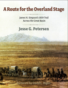
The 1859 exploration of the Great Basin by army topographical engineer James Simpson opened up one of the West's most important transportation and communication corridors, a vital link between the Pacific Coast and the rest of the nation. It became the route of the Pony Express and the Overland Mail and Stage, the line of the Pacific telegraph, a major wagon road for freighters and emigrants, and, later, the first transcontinental auto road, the Lincoln Highway, now Highway 50.

No one has accurately tracked or mapped Simpson's original route, until now. Jesse Petersen shows in words, maps, and photos exactly where the explorer went. Sharing his detective-like reasoning as he walked or drove the entire trail west and Simpson's variant route returning east, Petersen takes readers on a mountain and desert trek through some of America's most remote and striking landscapes.

[more]

front cover of Taking Society's Measure
Taking Society's Measure
A Personal History of Survey Research
Herbert Hyman
Russell Sage Foundation, 1991
How are we, as members of a society, informed of conditions that affect our social welfare? How does the government register the impact of its actions on its citizens? The turbulent 1930s saw the emergence of sample survey research as an increasingly valuable technique of social inquiry. Perhaps no one championed this nascent discipline as vigorously as Herbert Hyman, one of those pioneering investigators whose talents were so closely associated with the rapid growth of survey research that their professional careers and reputations became virtually indistinguishable from the field itself. Hyman's personal account is a remarkable contribution to the history and sociology of social research. His experiences with the U.S. Department of Agriculture, the Office of War Information, the U.S. Bombing Surveys of Germany and Japan, the National Opinion Research Center, and the Bureau of Applied Social Research are all documented with fascinating insight into the critical events and prominent individuals that shaped the field of survey research between the late 1930s and the late 1950s.
[more]

front cover of Wabanaki Homeland and the New State of Maine
Wabanaki Homeland and the New State of Maine
The 1820 Journal and Plans of Survey of Joseph Treat
Micah A. Pawling
University of Massachusetts Press, 2017
In late September 1820, hoping to lay claim to territory then under dispute between Great Britain and the United States, Governor William King of the newly founded state of Maine dispatched Major Joseph Treat to survey public lands on the Penobscot and Saint John Rivers. Traveling well beyond the limits of colonial settlement, Treat relied heavily on the cultural knowledge and expertise of John Neptune, lieutenant governor of the Penobscot tribe, to guide him across the Wabanaki homeland. Along the way Treat recorded his daily experiences in a journal and drew detailed maps, documenting the interactions of the Wabanaki peoples with the land and space they knew as home.

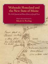
Edited, annotated, and with an introduction by Micah Pawling, this volume includes a complete transcription of Treat's journal, reproductions of dozens of hand-drawn maps, and records pertaining to the 1820 treaty between the Penobscot Nation and the governing authorities of Maine. As Pawling points out, Treat's journal offers more than the observations of a state agent conducting a survey. It re-creates a dialogue between Euro-Americans and Native peoples, showing how different perceptions of the land were negotiated and disseminated, and exposing the tensions that surfaced when assumptions and expectations clashed. In large part because of Neptune's influence, the maps, in addition to detailing the location of Wabanaki settlements, reflect a river-oriented Native perspective that would later serve as a key to Euro-American access to the region's interior.

The groundwork for cooperation between Treat and Neptune had been laid during the 1820 treaty negotiations, in which both men participated and which were successfully concluded just over a month before their expedition departed from Bangor, Maine. Despite conflicting interests and mutual suspicions, they were able to work together and cultivate a measure of trust as they traveled across northern Maine and western New Brunswick, mapping an old world together while envisioning its uncertain future.
[more]


Send via email Share on Facebook Share on Twitter