
 A SCHOLARLY BOOK REPOSITORY
Far into the Atlantic Ocean, the outflow from the Amazon River creates a "sweet sea" of fresh water. At the river's mouth, a vast delta of river channels and marshes, floodplain and upland forests, open and scrub savannas, floating meadows, and mangrove swamps hosts an astonishingly diverse assemblage of plant and animal life. So rich is this biological treasure house that early European explorers deemed it inexhaustible.
In this highly readable book, Nigel Smith explores how human use of the Amazon estuary's natural resources has been affected by technological change, rapid urban growth, and accelerated market integration. Avoiding alarmist rhetoric, he shows how human intervention in the estuary has actually diversified agriculture and helped save floodplain forests from wanton destruction. His findings underscore the importance of understanding the history of land use and the ecological knowledge of local people when formulating development and conservation policies. The book will be of interest to everyone concerned with the fate of tropical forests, conserving biodiversity, and developing natural resources in a sustainable manner.
Northern Michigan is undergoing unprecedented changes in land use, climate, resource extraction, and species distributions. For the last hundred years, the University of Michigan Biological Station has monitored these environmental transformations. Stretching 10,000 acres along Burt and Douglas Lakes in the northern Lower Peninsula and 3,200 acres on Sugar Island near Sault Ste. Marie, Michigan, the station has played host to nearly 10,000 students and a steady stream of top scientists in the fields of biology, ecology, geology, archeology, and climatology.
The Changing Environment of Northern Michigan collects essays by some of these scientists, who lead readers on virtual field trips exploring the history of people and science at the station itself, the relations of indigenous people to the land, the geophysical history of the region, characteristics of terrestrial and aquatic ecosystems, key groups of organisms and their relations to local habitats, and perspectives on critical environmental challenges of today and their effects on the region. Accompanying the chapters are color illustrations and photographs that bring the station's pristine setting to life.
Like the station itself, the book provides a solid background for better appreciating the relationships among living and nonliving parts of northern Michigan, for anyone interested in exploring the region's forests, fields, and wetlands; wading or paddling down its rivers; or swimming or floating across its lakes.
Knute J. Nadelhoffer is Director of the University of Michigan Biological Station and Professor of Ecology and Evolutionary Biology at the University of Michigan.
Alan J. Hogg, Jr., teaches science writing at the University of Michigan as a faculty member of the Sweetland Writing Center. His Ph.D. research explored the effects of ozone and nitrogen oxides on University of Michigan Biological Station forests.
Brian A. Hazlett is Professor Emeritus of Zoology at the University of Michigan.
In the urgently expanding field of environmental history, two trends are emerging. Research has internationalized, crossing political and historical borders. And urban spaces are increasingly seen as part of, not apart from, the global environment. In this book, Jeffry Diefendorf and Kurk Dorsey have gathered much of the important work pushing the field in new directions. Eleven essays by prominent and regionally diverse scholars address how human and natural forces collaborate in the creation of cities, the countryside, and empires.
The Cities section features essays that examine pollution and its aftermath in Pittsburgh, the Ruhr Valley (Germany), and Los Angeles. These urban areas are far apart on the globe but closely linked in their histories of how human decision making has affected the environment.
Changing rural and suburban spaces are the focus of Countryside. Elizabeth Blackmar "follows the money" in order to understand why the financing of suburban mall developments makes local resistance difficult. Studies of the fractious history of the creation of a wildlife refuge in Oregon and the ongoing impact of hydraulic mining in the early California goldmining era emphasize the misuse of technology in rural spaces.
Such misuse is a central idea of Empires. In "When Stalin Learned to Fish," Paul R. Josephson tells the story of Soviet fishing technology designed to "harness fish to the engine of socialism." Other essays explore the failures of Western agricultural technology in Africa and the relationship between such technology and disease in European attempts to conquer the Caribbean. In a stirring, wide-ranging consideration of the neo-European colonies (the United States, Australia, Canada, and New Zealand), Thomas R. Dunlap observes the ongoing, unsettled interaction of lands and dreams. An afterword by Alfred W. Crosby, an eminent scholar of environmental history, closes the book with a broad and insightful synthesis of the history and future of this critical field.
Chapters address place-making in Chaco Canyon, recent trends in landscape archaeology, the formation of identities, landscape boundaries, and the movement associated with these aspects of place-making. They address how interaction of peoples with objects brings landscapes to life. Representing a diverse cross section of Southwestern archaeologists, the authors of this volume push the boundaries of archaeological method and theory, building a strong foundation for future Southwest studies.
This book will be of interest to professional and academic archaeologists, as well as students working in the American Southwest.
Over the past century American agriculture has shifted dramatically with small, commercial farms finding it increasingly difficult to compete with large-scale (mostly indoor) animal feeding operations (AFOs). In this book, Terence J. Centner investigates the environmental, social, economic, and political impact of the rise of the so-called factory farm, exposing the ramifications of the contemporary trend toward industrial-scale food production.
Just as Rachel Carson's landmark Silent Spring used the disappearance of songbirds as a jumping-off point for a work that raised public awareness of pesticides' devastating environmental impact, Empty Pastures sees the dwindling numbers of livestock in the American countryside as a symptom of a broader transformation, one with serious consequences for the rural landscape and its inhabitants--animal as well as human.
After outlining the rise of the AFO, Centner examines the troubling consequences of consolidation in animal farming and suggests a number of remedies. The issues he tackles include groundwater contamination, the loss of biodiversity, animal welfare, concentrated odors and other nuisances, soil erosion, and the economic effects of the disappearance of the small family farm.
Inspired by largely abandoned traditional practices rather than a radical and unrealistic vision of a return to an idealized past, Centner proposes a series of pragmatic reforms for regulating factory farms to halt ecological degradation and revitalize rural communities.
Crummey draws on photographs comparing identical landscapes in 1937 and 1997 as well as interviews with local farmers, among other sources. He reveals that forestation actually increased due to farmers' tree-planting initiatives. More broadly, he shows that, in the face of growing environmental stress, Ethiopian farmers have innovated and adapted. Yet the threat of famine remains because of constricted access to resources and erratic rainfall. To avoid future famines, Crummey suggests, Ethiopia's farmers must transform agricultural productivity, but they cannot achieve that on their own.
Drawing upon published sources, oral histories, and previously unused archival documents, Jeffrey P. Shepherd situates the Guadalupe Mountains and the national park in the context of epic tales of Spanish exploration, westward expansion, Native survival, immigrant settlement, the conservation movement, early tourism, and regional economic development. As Americans cope with climate change, polarized political rhetoric, and suburban sprawl, public spaces such as Guadalupe Mountains National Park remind us about our ties to nature and our historical relationships with the environment.
This book focuses on changing land-use patterns and their relationship to socio-political organization. Using a combination of archaeological and environmental data, Brett Hill examines the human ecology of agriculture and pastoralism from the beginnings of domestication through the rise and collapse of complex societies. Models of land use often consider political complexity as an important factor affecting mismanagement. Together with GIS erosion modeling and settlement pattern analysis, Hill evaluates the archaeological, historical, and environmental record spanning the Holocene to show how land use was affected by the rise of centralized authority. Yet populations in the Hasa maintained the ability to resist authority and return to a nomadic life when it became advantageous. This process emphasizes the power of local groups to pursue alternative strategies when their interests diverged from those of elites, creating a dynamic that reshapes the landscape each generation.
Hill’s analysis contributes significantly to our understanding of the history of human ecology in the southern Levant, wherein current debates are complicated by research at different scales and by a lack of consensus on the importance of localized phenomena. It not only complements existing research but also seeks to refine models of processes in human ecology to demonstrate the effect of political organization on land mismanagement.
Many students come to African history with a host of stereotypes that are not always easy to dislodge. One of the most common is that of Africa as safari grounds—as the land of expansive, unpopulated game reserves untouched by civilization and preserved in their original pristine state by the tireless efforts of contemporary conservationists. With prose that is elegant in its simplicity and analysis that is forceful and compelling, Jan Bender Shetler brings the landscape memory of the Serengeti to life. She demonstrates how the social identities of western Serengeti peoples are embedded in specific spaces and in their collective memories of those spaces. Using a new methodology to analyze precolonial oral traditions, Shetler identifies core spatial images and reevaluates them in their historical context through the use of archaeological, linguistic, ethnographic, ecological, and archival evidence. Imagining Serengeti is a lively environmental history that will ensure that we never look at images of the African landscape in quite the same way.
Turner's discussions of the photographs and the conclusions he draws provide an important reference for ecologists, geographers, botanists, and other researchers attempting similar studies. By documenting vegetation change in a region broadly similar climatically to North America's subtropical deserts and grasslands but different in its wildlife and its human culture, the book shows that the endpoints of landscape status are similar despite the vastly different histories of these two regions of the world.
A Land Between Waters explores the relationship between the people and the environment in Mexico. It heralds the arrival of environmental history as a major area of study within the field of Mexican history. This volume brings together a dozen original works of environmental history by some of the foremost experts in Mexican environmental history from both the United States and Mexico.
The contributions collected in this seminal volume explore a wide array of topics, from the era of independence to the present day. Together they examine how humans have used, abused, and attended to nature in Mexico over more than two hundred years. Written in clear, accessible prose, A Land Between Waters showcases the breadth of Mexican environmental history in a way that defines the key topics in the field and suggests avenues for subsequent work. Most importantly, it assesses the impacts of environmental changes that Mexico has faced in the past with an eye to informing national debates about the challenges that the nation will face in the future.
Most people equate Los Angeles with smog, sprawl, forty suburbs in search of a city-the great "what-not-to-do" of twentieth-century city building. But there's much more to LA's story than this shallow stereotype. History shows that Los Angeles was intensely, ubiquitously planned. The consequences of that planning-the environmental history of urbanism--is one place to turn for the more complex lessons LA has to offer.
Working forward from ancient times and ancient ecologies to the very recent past, Land of Sunshine is a fascinating exploration of the environmental history of greater Los Angeles. Rather than rehearsing a litany of errors or insults against nature, rather than decrying the lost opportunities of "roads not taken," these essays, by nineteen leading geologists, ecologists, and historians, instead consider the changing dynamics both of the city and of nature.
In the nineteenth century, for example, "density" was considered an evil, and reformers struggled mightily to move the working poor out to areas where better sanitation and flowers and parks "made life seem worth the living."
We now call that vision "sprawl," and we struggle just as much to bring middle-class people back into the core of American cities. There's nothing natural, or inevitable, about such turns of events. It's only by paying very close attention to the ways metropolitan nature has been constructed and construed that meaningful lessons can be drawn. History matters.
So here are the plants and animals of the Los Angeles basin, its rivers and watersheds. Here are the landscapes of fact and fantasy, the historical actors, events, and circumstances that have proved transformative over and over again. The result is a nuanced and rich portrait of Los Angeles that will serve planners, communities, and environmentalists as they look to the past for clues, if not blueprints, for enhancing the quality and viability of cities.
Contributors from North America, Australia, New Zealand, Taiwan, and Europe explore a wide variety of case studies that includes seascapes in Jamaica; the Solomon Islands; the forests of Madagascar; Aboriginal and European notions of landscape in Australia; place and identity in 19th century maps and the bogs of Ireland; contemporary concerns over changing landscapes in Papua New Guinea; and representations of landscape and history in the poetry of the Scottish Borders.
Radding’s comparative approach illuminates what happened when similar institutions of imperial governance, commerce, and religion were planted in different physical and cultural environments. She draws on archival documents, published reports by missionaries and travelers, and previous histories as well as ecological studies and ethnographies. She also considers cultural artifacts, including archaeological remains, architecture, liturgical music, and religious dances. Radding demonstrates how colonial encounters were conditioned by both the local landscape and cultural expectations; how the colonizers and colonized understood notions of territory and property; how religion formed the cultural practices and historical memories of the Sonoran and Chiquitano peoples; and how the conflict between the indigenous communities and the surrounding creole societies developed in new directions well into the nineteenth century.
Cordova focuses on geoarchaeological and cultural ecological aspects of research, presenting data from physical, chemical, and biological sources. He examines the changing influence of climate, vegetation, and hunting opportunities on cultural exploitation tactics, as well as the effects of the growing population and agriculture on the environment. Cordova argues that an interdisciplinary approach to studying the area is crucial to achieving a true understanding of Jordan’s changing landscape.
Chapter topics include approaches to the study of ancient Jordanian landscapes in the Near Eastern context; the physical scene; endowed landscapes of the woodlands; the encroaching drylands; the current and future state of the paleoecological and geoarchaeological record; patterns of millennial landscape change; and the process of interpreting millennial landscape change. The text is abundantly illustrated with photos, line illustrations, tables, and maps, providing a valuable assessment of archaeological developments over the prehistory and history of what today is the Hashemite Kingdom of Jordan. This volume will be especially welcomed by scholars interested in the archaeology, history, and geography of Jordan, the Levant, and the Near East and by field-school students working on archaeological projects in Jordan.
Particular attention is paid to the various ways that archaeology can and should contribute to contemporary social and environmental issues. Contributors come together to provide a synthetic volume on current research and possibilities for future explorations. Moving forward, they argue that archaeologists must continue to include researchers from across political and disciplinary boundaries and enhance collaboration with Native American groups.
This book will be of interest to professional and academic archaeologists, as well as students working in the field of the American Southwest.
In this groundbreaking study, Jacob A. Tropp explores the interconnections between negotiations over the environment and an emerging colonial relationship in a particular South African context—the Transkei—subsequently the largest of the notorious “homelands” under apartheid.
In the late nineteenth century, South Africa’s Cape Colony completed its incorporation of the area beyond the Kei River, known as the Transkei, and began transforming the region into a labor reserve. It simultaneously restructured popular access to local forests, reserving those resources for the benefit of the white settler economy. This placed new constraints on local Africans in accessing resources for agriculture, livestock management, hunting, building materials, fuel, medicine, and ritual practices.
Drawing from a diverse array of oral and written sources, Tropp reveals how bargaining over resources—between and among colonial officials, chiefs and headmen, and local African men and women—was interwoven with major changes in local political authority, gendered economic relations, and cultural practices as well as with intense struggles over the very meaning and scope of colonial rule itself.
Natures of Colonial Change sheds new light on the colonial era in the Transkei by looking at significant yet neglected dimensions of this history: how both “colonizing” and “colonized” groups negotiated environmental access and how such negotiations helped shape the broader making and meaning of life in the new colonial order.
For millennia the ecology of the Great Basin has evolved because of climate change and the impacts of human presence. Nevada’s Changing Wildlife Habitat is the first book to explain the transformations in the plants and animals of this region over time and how they came about. Using data gleaned from archaeological and anthropological studies, numerous historical documents, repeat photography, and several natural sciences, the authors examine changes in vegetation and their impact on wildlife species and the general health of the environment. They also outline the choices that current users and managers of rangelands face in being good stewards of this harsh but fragile environment and its wildlife.
This volume explores the technical and geographic scope of this important technique, focusing particularly on the intertwined influences of climatic variation and land-use practices in sculpting landscapes. Contributors offer a broad-perspective review of the state-of-the-art of repeat photography, with twenty-three chapters written by researchers around the globe who have made use of repeat photography in their work. Topics addressed include
the history of repeat photography
techniques for creating and analyzing repeat photographs
applications in the geosciences
applications in population ecology
applications in ecosystem change
cultural applications
Repeat Photography demonstrates the wide range of potential applications, examines new techniques for acquiring data from repeat photography, and clearly shows that repeat photography remains a valuable and efficient means of monitoring change in both developed and developing regions. Over one hundred sets of photographs, including thirty-two pages of color photos, serve as examples.
Recent concerns about climate change and its effects on natural landscapes, combined with ongoing concerns about land-use practices, make this state-of-the-art review a timely contribution to the literature.
The site that would become Sacramento was settled in 1839, when Johann Augustus Sutter attempted to convert his Mexican land grant into New Helvetia (or “New Switzerland”). It was at Sutter’s sawmill fifty miles to the east that gold was first discovered, leading to the California Gold Rush of 1849. Nearly overnight, Sacramento became a boomtown, and cityhood followed in 1850.
Ideally situated at the confluence of the American and Sacramento Rivers, the city was connected by waterway to San Francisco and the surrounding region. Combined with the area’s warm and sunny climate, the rivers provided the necessary water supply for agriculture to flourish. The devastation wrought by floods and cholera, however, took a huge toll on early populations and led to the construction of an extensive levee system that raised the downtown street level to combat flooding. Great fortune came when local entrepreneurs built the Central Pacific Railroad, and in 1869 it connected with the Union Pacific Railroad to form the first transcontinental passage. Sacramento soon became an industrial hub and major food-processing center. By 1879, it was named the state capital and seat of government.
In the twentieth century, the Sacramento area benefitted from the federal government’s major investment in the construction and operation of three military bases and other regional public works projects. Rapid suburbanization followed along with the building of highways, bridges, schools, parks, hydroelectric dams, and the Rancho Seco nuclear power plant, which activists would later shut down. Today, several tribal gaming resorts attract patrons to the area, while “Old Sacramento” revitalizes the original downtown as it celebrates Sacramento’s pioneering past.
This environmental history of Sacramento provides a compelling case study of urban and suburban development in California and the American West. As the contributors show, Sacramento has seen its landscape both ravaged and reborn. As blighted areas, rail yards, and riverfronts have been reclaimed, and parks and green spaces created and expanded, Sacramento’s identity continues to evolve. As it moves beyond its Gold Rush, Transcontinental Railroad, and government-town heritage, Sacramento remains a city and region deeply rooted in its natural environment.
The four sections in Rivers Lost, Rivers Regained discuss how cities have gained control and exerted power over rivers and waterways far upstream and downstream; how rivers and floodplains in cityscapes have been transformed by urbanization and industrialization; how urban rivers have been represented in cultural manifestations, such as novels and songs; and how more recent strategies work to redefine and recreate the place of the river within the urban setting.
At the nexus between environmental, urban, and water histories, Rivers Lost, Rivers Regained points out how the urban-river relationship can serve as a prime vantage point to analyze fundamental issues of modern environmental attitudes and practices.
In this book, Eric Sandweiss scrutinizes the everyday landscape -- streets, houses, neighborhoods, and public buildings -- as it evolved in a classic American city. Bringing to life the spaces that most of us pass without noticing, he reveals how the processes of dividing, trading, improving, and dwelling upon land are acts that reflect and shape social relations. From its origins as a French colonial settlement in the eighteenth century to the present day, St. Louis offers a story not just about how our past is diagrammed in brick and asphalt, but also about the American city's continuing viability as a place where the balance of individual rights and collective responsibilities can be debated, demonstrated and adjusted for generations to come.
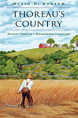
In 1977 David Foster took to the woods of New England to build a cabin with his own hands. Along with a few tools he brought a copy of the journals of Henry David Thoreau. Foster was struck by how different the forested landscape around him was from the one Thoreau described more than a century earlier. The sights and sounds that Thoreau experienced on his daily walks through nineteenth-century Concord were those of rolling farmland, small woodlands, and farmers endlessly working the land. As Foster explored the New England landscape, he discovered ancient ruins of cellar holes, stone walls, and abandoned cartways--all remnants of this earlier land now largely covered by forest. How had Thoreau's open countryside, shaped by ax and plough, divided by fences and laneways, become a forested landscape?
Part ecological and historical puzzle, this book brings a vanished countryside to life in all its dimensions, human and natural, offering a rich record of human imprint upon the land. Extensive excerpts from the journals show us, through the vividly recorded details of daily life, a Thoreau intimately acquainted with the ways in which he and his neighbors were changing and remaking the New England landscape. Foster adds the perspective of a modern forest ecologist and landscape historian, using the journals to trace themes of historical and social change.
Thoreau's journals evoke not a wilderness retreat but the emotions and natural history that come from an old and humanized landscape. It is with a new understanding of the human role in shaping that landscape, Foster argues, that we can best prepare ourselves to appreciate and conserve it today.
From the journal:
"I have collected and split up now quite a pile of driftwood--rails and riders and stems and stumps of trees--perhaps half or three quarters of a tree...Each stick I deal with has a history, and I read it as I am handling it, and, last of all, I remember my adventures in getting it, while it is burning in the winter evening. That is the most interesting part of its history. It has made part of a fence or a bridge, perchance, or has been rooted out of a clearing and bears the marks of fire on it...Thus one half of the value of my wood is enjoyed before it is housed, and the other half is equal to the whole value of an equal quantity of the wood which I buy."
--October 20, 1855
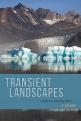
Landscape—the unique combination of landforms, plants, animals, and weather that compose any natural place—is inherently transient. Each essay in Transient Landscapes introduces this idea of a constantly metamorphosing global landscape, revealing how to see the ubiquity of landscape transience, both that which results through Earth’s natural environmental and climatological processes and that which comes from human intervention.
The essays are grouped by type of environmental change: long-term, large-scale transformation driven by geologic forces such as tectonic uplift and volcanism; natural variability at shorter time scales, such as seasonal flooding; and modifications resulting from human activities, such as timber harvest, land drainage, and pollution. Each essay is set in a unique geographic location—including such diverse places as New Zealand, Northern California, Costa Rica, and the Scottish Highlands—and is largely drawn from Wohl’s personal experience researching in the field.
A combination of travel writing, nature writing, and science writing, Transient Landscapes is a beautiful and thoughtful journey through the natural world.
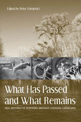
Thirteen narratives—from ranchers, foresters, scientists, Native American farmers, and others—tell how northern Arizona landscapes and livelihoods reflect rapid social and environmental change. The twentieth century saw huge changes as Arizona’s human population swelled and vacation-home developments arose in the backcountry. Riparian areas dried up, cattle ranching declined, and some wildlife species vanished while others thrived. The people whose words are preserved here have watched it all happen.
The book is a product of Northern Arizona University’s Ecological Oral Histories project, which has been collecting remembrances of long-time area residents who have observed changes to the land from the 1930s to the present day. It carves a wide swath, from the Arizona Strip to the Mogollon Rim, from valleys near Prescott to the New Mexico line. It takes readers to the Bar Heart Ranch north of Williams and to the Doy Reidhead Ranch southeast of Holbrook, to the forests of Flagstaff and the mesas of Indian country.
Enhanced with more than fifty illustrations, this book brings environmental change down to earth by allowing us to see it through the eyes of those whose lives it has directly touched. What Has Passed and What Remains is a window on the past that carries important lessons for the future.
READERS
Browse our collection.
PUBLISHERS
See BiblioVault's publisher services.
STUDENT SERVICES
Files for college accessibility offices.
RECENTLY PUBLISHED


")


UChicago Accessibility Resources
home | accessibility | search | about | contact us
BiblioVault ® 2001 - 2024
The University of Chicago Press