The Safford Valley Grids: Prehistoric Cultivation in the Southern Arizona Desert
by William E. Doolittle and James A. Neely
University of Arizona Press, 2004
Paper: 978-0-8165-2428-0
Library of Congress Classification E78.A7S23 2004
Dewey Decimal Classification 979.15401
Paper: 978-0-8165-2428-0
Library of Congress Classification E78.A7S23 2004
Dewey Decimal Classification 979.15401
ABOUT THIS BOOK | AUTHOR BIOGRAPHY | TOC
ABOUT THIS BOOK
Crisscrossing Pleistocene terrace tops and overlooking the Gila River in southeastern Arizona are acres and acres of rock alignments that have perplexed archaeologists for a century. Well known but poorly understood, these features have long been considered agricultural, but exactly what was cultivated, how, and why remained a mystery. Now we know. Drawing on the talents of a team of scholars representing various disciplines, including geology, soil science, remote sensing, geographical information sciences (GISc), hydrology, botany, palynology, and archaeology, the editors of this volume explain when and why the grids were built.
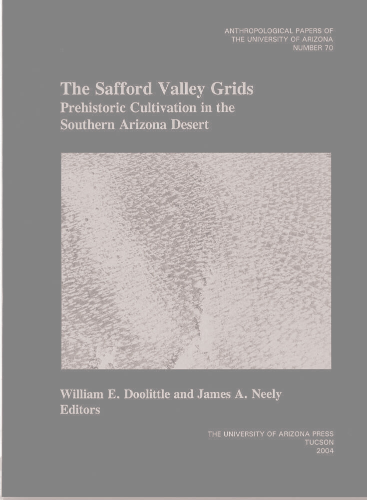
Between A.D. 750 and 1385, people gathered rocks from the tops of the terraces and rearranged them in grids of varying size and shape, averaging about 4 meters to 5 meters square. The grids captured rainfall and water accumulated under the rocks forming the grids. Agave was planted among the rocks, providing a dietary supplement to the maize and beans that were irrigated on the nearby bottom land, a survival crop when the staple crops failed, and possibly a trade commodity when yields were high. Stunning photographs by Adriel Heisey convey the vastness of the grids across the landscape.
Between A.D. 750 and 1385, people gathered rocks from the tops of the terraces and rearranged them in grids of varying size and shape, averaging about 4 meters to 5 meters square. The grids captured rainfall and water accumulated under the rocks forming the grids. Agave was planted among the rocks, providing a dietary supplement to the maize and beans that were irrigated on the nearby bottom land, a survival crop when the staple crops failed, and possibly a trade commodity when yields were high. Stunning photographs by Adriel Heisey convey the vastness of the grids across the landscape.
AUTHOR BIOGRAPHY
William E. Doolittle is the Erich W. Zimmermann Regents Professor in Geography and the Chairman of the Department of Geography at The University of Texas at Austin and author of Cultivated Landscapes of Native North America. James A. Neely is Professor Emeritus of Anthropology and Archaeology at The University of Texas at Austin and the author of several publications on water management and irrigation in the American Southwest, Pueblo and Oaxaca in Mexico, and the Deh Luran Plain of Iran.
TABLE OF CONTENTS
Contents
Preface xiii
Acknowledgments xiv
1. A Checkered Landscape 1
 William E. Doolittle and James A. Neely
 Grids, Grids, and More Grids 1
 Waffle Gardens 1
 Pebble-mulch Gardens 3
 Rock-bordered Grids 5
 The Safford Valley Grids 5
 Previous Research 7
 The Cast of Characters 7
 Differing Interpretations 7
 Consensus on Interpretation 8
 The Grids are Not Alone 9
 Other Evidence of Human Occupation 10
 Additional Thoughts 10
 1994 Reconnaissance 12
 Addressing the Issues 12
 Proposition of Age 12
 Proposition of Construction 15
 Proposition of Purpose 15
 Proposition of Function 16
2. Paleoclimatic and Archaeological Contexts 18
 James A. Neely
 History of Climate from
 150 B.C. to A.D. 1450 18
 Early Formative Period 18
 Late Formative Period 18
 Classic Period 20
 The Archaeological Perspective 20
 Prehistoric Cultural Developments
 in the Safford Valley 21
 Paleoindian and Archaic Occupations 21
 Early Formative Period 23
 Late Formative 24
 Classic Period 26
 Findings and Meanings 30
3. Geologic Setting 31
 Brenda B. Houser
 Regional Geologic Setting 31
 Local Stratigraphy 32
 Upper Basin Fill 32
 Gila River Alluvium on Terraces 33
 Loess 34
 Piedmont Alluvium 34
 Gila River Alluvium of the
 Floodplain and Channel 34
 Geology of the Gila Mountains 34
 Geology of the Southwest
 Piedmont Slope 36
 Findings and Meanings 37
4. Landscape Context: Gis Analysis and Mapping 38
 Dale R. Lightfoot
 Aerial Photography and Mapping 38
 GIS Analysis 39
 Measures of Area and Length 39
 Association with Soils 42
 Association with Geology 42
 A Symmetry of Pattern: Big
 Spring Wash as Central Place 44
 Findings and Meanings 46
5. Site Topography and Hydrology 48
 William E. Doolittle
 Terraces 48
 Grids 54
 Findings and Meanings 60
6. Soil Investigations 62
 Jeffrey A. Homburg, Jonathan A. Sandor,
 and Dale R. Lightfoot
 Methods 62
 Soil Mapping Data 64
 Previous Soil Testing Data 65
 Review of Soil Tests 65
 Soil Morphological Properties and
 Their Agricultural Implications 67
 Physical and Chemical Soil
 Testing Data 69
 Granulometric Tests 76
 Soil Moisture: The Cobble-Mulch Effect 77
 Findings and Meanings 78
7. Growing Conditions and Crops: the Field Evidence 79
 Suzanne K. Fish, Paul R. Fish, Arthur
 MacWilliams, Guadalupe S nchez de
 Carpenter, and Karen R. Adams
 Modern Vegetation Responses 79
 Pollen Analysis 83
 Roasting Pits 87
 Reconnaissance 87
 Excavations 88
 Plant Remains 88
 Dating 89
 Artifact Collections 90
 Magnitude of Production 92
 Findings and Meanings 93
8. Archaeological Perspective 95
 James A. Neely
 The Rock-bordered Grids 95
 Big Spring Wash and Vicinity 95
 Boundary Markers Among the
 Grids and Terraces 96
 Features and Structures 97
 Roasting Pits among the Grids 97
 Rock Mound Feature 1 98
 Structures 98
 Excavation of Field House
 Structure 1 105
 The Artifacts 107
 Ceramics 107
 Flaked Stone 110
 Ground Stone 110
 Hand-held Stone Hoes 110
 Tabular Knives 110
 Findings and Meanings 111
9. Rock Art 112
 Betty Graham Lee and William E. Doolittle
 Sites and Localities 112
 Methodology 113
 Assessment of Conditions 115
 Interpretations 115
 Shrines 116
 Water 117
 Trade 117
 Disclaimers 122
 Cultures and Dates 123
 Findings and Meanings 124
10. Answers and Ideas 125
 James A. Neely and William E. Doolittle
 Age 125
 Construction 125
 Purpose 126
 Function 126
 Labor Inputs 127
 Production 127
 Agave without Grids 127
 The Role of Grids in the
 Prehistoric Safford Valley 128
 Archaeological Findings and the
 Central Place Designation 128
 Cultivation, Processing, and
 Uses of Agave 128
 The Role of Agave in the Mixed
 Subsistence System 130
 Rock-bordered Grid Fields and
 Settlement Pattern 131
 Chronological Placement of
 Site AZ CC:1:2 (ASM) 132
 Discussion of the Chronological
 Placements 134
 A Reconstructed History of
 Site AZ CC:1:2 (ASM) 135
 Social Organization Implications
 at Site AZ CC:1:2 (ASM) 136
 Comparison of AZ CC:1:2 (ASM) with
 Other Agricultural Field Sites 137
 General Observations 140
 Afterthoughts 140
Appendix A: Soil Profile Descriptions 143
 Jonathan A. Sandor and Jeffrey A. Homburg
 Profile Description 1 143
 Profile Description 2 144
 Profile Description 3 145
 Profile Description 4 145
 Profile Description 5 146
 Profile Description 6 146
Appendix B: Microscopic Analysis of a
 Tabular Knife 149
 Marilyn Shoberg
 Findings and Meanings 151
References 153
Index
Figures
1.1. Waffle gardens at Zuni Pueblo, about 1910 2
1.2. One of only two waffle gardens remaining
 at Zuni Pueblo in 1988 3
1.3.A pebble-mulch grid field on a Pleistocene
 terrace overlooking the Rio Chama, New
 Mexico 4
1.4. A subdivided pebble-mulch grid field in
 the Chama Valley, New Mexico 4
1.5. The Safford Valley, showing locations
 of site AZ CC:1:2 (ASM), and various
 physical and cultural features 6
1.6. Map of site AZ CC:1:2 (ASM), grid
 localities, and other cultural and
 physical features 11
1.7. Grids with large rocks at Locality 4 13
1.8. Grids at Locality 5 13
1.9 Grids at Locality 6 13
1.10. Grids at Locality 2, with a rock
 pile in the center of one grid 13
1.11. Long rock alignment ("diversion dam")
 at Locality 6 13
1.12.Short rock alignment ("checkdam") at
 Locality 1 13
1.13. An upslope view of terraces at Locality 1 14
1.14 A rock pile field adjacent to rock-
 bordered grids at Locality 1 14
1.15. Schematic diagram of grid-to-terrace
 transition at Locality 4 14
1.16. Upturned boulder with distinct variations
 in patina from one side to the other 15
1.17. Undisturbed or in situ boulder with
 distinct variations in patina from
 top to bottom 15
1.18. Small rock "ring" at Locality 1 15
2.1. The Safford Valley showing its
 geographic relationship to
 neighboring archaeological areas 19
2.2. Chronology and phase sequence for the
 later occupations of the Safford Valley
 and adjacent regions 22
3.1. Simplified geologic map of the Safford
 Valley and Gila Mountains showing
 locations of rock-bordered grids 32
3.2. Partial map of geologic contacts
 in part of the area of rock-
 bordered grids 33
3.3. Fine-grained fluvial facies of upper
 basin fill 34
3.4. Gila River terrace alluvium capped
 by a lenticular loess deposit 35
3.5. Pebbly Gila River terrace alluvium
 overlain by loess that is overlain
 by piedmont alluvium 35
3.6. Loess deposit showing root casts
 and paleosol horizons 36
3.7. Pebbly Gila River terrace alluvium
 overlain by loess that is overlain
 by piedmont alluvium 37
4.1. Rock-bordered grids and associated
 ancient and present-day landscape
 features 40-41
4.2. Map showing association between
 rock-bordered grids and soils 43
4.3. Map showing association between
 rock-bordered grids and geology 44
4.4. Buffer analysis map showing areas of
 rock-bordered grids associated with
 corridors set at 0.5 km, 0.5-1 km,
 and 1.0-1.5 km on either side of Big
 Spring Wash 45
4.5. Graph of symmetrical diminution of
 rock-bordered grids with distance
 east and west of Big Spring Wash 46
5.1. An uncleared and unterraced
 portion of a slope 48
5.2. View from the base toward the top
 of the terraced slope 49
5.3. Profile of the terraced slope 49
5.4. Close-up view, up slope, of intact
 terrace alignments 50
5.5. Close-up view along a terrace
 alignment 51
5.6. Close-up view of Terrace 6
 after excavation 51
5.7. Profile of Terraces 5, 6, and 7 51
5.8. View down the terraced slope, showing
 both risers and cross walls 52
5.9. View up the terraced slope, showing
 possible boundary markers 52
5.10. Rock-bordered grids on an apparently
 flat surface 55
5.11. Rock-bordered grids on a surface that
 slopes more than is first perceptible 55
5.12. Plan of the rock-bordered grids at the
 eastern edge of Locality 1 56
5.13. Plan of rock-bordered grids at the
 eastern edge of Locality 1, with arrows
 showing the directions of surface
 gradients and hence runoff 57
6.1. Aerial photograph of Locality 1, showing
 the locations of soil testing shovel
 pits, trenches, and prospectors' pits 63
6.2. Thick petrocalcic horizon exposed in
 Prospector Pit 1 68
6.3. Shallow petrocalcic horizon below terraces
 and rock alignments in Trench 1 68
6.4. Argillic horizon in prospectors' pit 2,
 surrounded by desert pavement 68
6.5. Histograms of soil data by sample
 context 71
7.l. Herbaceous annual plants growing more
 profusely in a rock grid border than in
 a grid interior at Locality 1 80
7.2. Herbaceous annual plants blooming in a
 rock pile but not in surrounding rock-
 free areas at Locality 1 80
7.3. Creosote bush growing on and between
 rock-bordered grids in December 1960 81
7.4. Creosote bush growing on and between
 rock-bordered grids in March 1997 81
7.5. Oblique aerial photograph of Locality 4,
 showing creosote bush growing on grid
 borders rather than in grid interiors 82
7.6. Plan and excavation profile of
 Roasting Pit 1 88
7.7. Plan and excavation profile of
 Roasting Pit 2 88
7.8. Plan and excavation profile of
 Roasting Pit 3 89
7.9. Tabular knives from site
 AZ CC:1:2 (ASM) 91
7.10. Core scrapers or pulping planes from
 site AZ CC:1:2 (ASM) 91
8.1. Pit House Locality 1 and vicinity 96
8.2. Rock Mound Feature 1, possibly a shrine 98
8.3. Field House Structure 2 102
8.4. Plan of Field House Structure 1 102
8.5. Hand-held stone "hoe" or digging tool 110
9.1. Site AZ CC:1:20 (ASM), looking
 northwest 113
9.2. Humpback flute player shrine at
 Locality 4 118
9.3. Circles and lines, possibly a solar motif 118
9.4. A serpent, possibly representing
 flowing water 118
9.5. Geoglyph/petroglyph shrine at Locality 6 118
9.6. Concentric square and wavy line motif,
 possibly representing a spring 118
9.7. Circles or spiral at site
 AZ CC:1:20 (ASM) 118
9.8. Interlocking lines, possibly repre-
 senting flowing water 119
9.9. An X motif, possibly an abstraction
 for trade 119
9.10. Anthropomorph and pit and
 groove motifs 119
9.11. Abstract curvilinear and
 quadruped motifs 120
9.12. Sketch of same petroglyph
 photographed in Figure 9.11 120
9.13. An X-shaped walking anthropomorph with
 a load, possibly representing trade 120
9.14. Abstract curvilinear motif at site
 AZ CC:1:20 (ASM) 120
9.15. Circles with lines, possibly an
 abstraction for trade 120
9.16. Animal and spiral within circle motifs 120
9.17. Partial anthropomorph or a bird
 in flight 121
9.18. Sketch of quadruped or rake motif
 petroglyph 121
9.19. Abstract curvilinear and
 anthropomorph motifs 121
9.20. Partial anthropomorph 122
10.1. Agaves on the north-facing upper
 bajada slopes of the Pinaleño
 Mountains 130
B.1. Tabular knife found near Field House
 Structure 1, Locality 9, site
 AZ CC:1:2 (ASM) 149
B.2. Photomicrograph of a smoothed,
 polished point on the edge of
 a tabular knife 150
B.3. Photomicrograph of linear strips of
 reticulate polish parallel to the long
 axis of a tabular knife 150
B.4. Photomicrograph of weakly developed
 polish on the high spots of the
 tool surface 150
B.5.Photomicrograph of smooth, pitted
 polish on the surface of an
 experimental prismatic blade
 of Edwards chert 151
B.6.Photomicrograph of fine, linear
 striations parallel to the long
 axis of the tool 151
B.7. Photomicrograph of the opposite face
 of the tool, showing similarly fine
 striae oriented at a slightly oblique
 angle to the long axis 151
Tables
5.1. Cross-section dimensions of terrace
 alignments 50
5.2. Terrace surface gradients 53
5.3. Detailed terrace surface gradients 53
5.4. Cross-section dimensions of rock borders 56
5.5. Rock-bordered grid sizes 58
5.6. Topography and hydrology of
 rock-bordered grids 59
6.1. Previous soil testing results obtained by
 the University of Arizona 65
6.2. Soil Chemistry and bulk density data for
 soil profiles 70
6.3. Particle-sizes by percent in sediments
 of soil profiles 70
6.4. Soil chemistry and bulk density data
 for grid features, terraces, rock
 piles, and their control areas 72
6.5. Particle sizes by percent in sediments
 of grid features, terraces, rock piles,
 and their control areas 73
6.6. Means and standard deviations for
 soil chemistry and bulk density tests 74
6.7. Means and standard deviations for
 particle-size analysis 74
6.8 t-Test probabilities for pair-wise
 comparisons of suspected cultivated
 and uncultivated soils 74
6.9. Percent change in weight of rock
 material within grids compared with
 rock material outside of grids 76
6.10. Percent change in weight of rock material
 in the 0-5 cm level compared with the
 5-10 cm level within and outside of grids 77
6.11.Relative measures of moisture content
 within and outside of grids 77
7.1.Comparison of creosote bush distribu-
 tion on rock alignments and control
 areas 82
7.2. Names of pollen taxa in samples 83
7.3.Values for major pollen taxa in
 site AA CC:1:2 (ASM) 84-85
7.4. Minor taxa in pollen spectra 86
7.5. Comparison of weedy pollen types in
 upper slope samples 86
7.6. Quantity of charred plant remains
 from roasting pits 89
7.7. Radiocarbon dates of roasting pits 90
7.8. Comparison of artifact collections
 from the Marana Community and rock-
 bordered grids 90
7.9. Frequencies of formal stone tools from
 Marana fields and rock-bordered grids 92
7.10. Comparison of production estimates for
 site AZ CC:1:2 (ASM) and the Marana
 fields 93
8.1.Lithics from Pit House Locality 1 and
 Rock Mound Feature 1, surface 99
8.2. Ceramics from survey and excava-
 tion at site AZ CC:1:2 (ASM) 100-101
8.3. Lithics from Field House Structure 1
 and Structure 2 103
8.4.Lithics from Field House Structure 1 104
8.5. Dating of ceramic types 108
9.1. Descriptions of petroglyphs 114
9.2. Assessment of petroglyph boulder
 conditions by site 115
10.1 Chronological placement of site
 AZ CC:1:2 (ASM) 133
10.2. Comparison of selected prehistoric
 field systems in southern Arizona 138-139
See other books on: Doolittle, William E. | Neely, James A. | Plant remains (Archaeology) | Rock gardens | Terracing
See other titles from University of Arizona Press
Nearby on shelf for America / Indians of North America:
|


, British Columbia: Spatial Distributions of Features, Lithic Artifacts, and Faunal Remains on Fifteen Anthropogenic Floors from Housepit 54")


9780816503605
9780870135019


