front cover of Canyon
Canyon
Michael P. Ghiglieri
University of Arizona Press, 1992
Fasten your life jackets for a ride you'll never forget. Now the excitement of a raft trip through the Grand Canyon has been re-created by a seasoned whitewater guide with a passion to share one of the world's most fantastic journeys. Michael Ghiglieri, a professional river guide for more than 17 years, has written the first book to describe that trip from the modern boatman's point of view.

From Lee's Ferry to Diamond Creek, Ghiglieri leads you down 226 miles of wild river and through some of the most breathtaking scenery on earth. Along the way, he navigates the Colorado River's dozens of notorious rapids—many of which drop fifteen feet or more—and shares the excitement of waves and boulders, thunder and foam. Recounting a real journey through this geological wonder, Canyon interweaves heart-pounding adventure with factual insights into the world of Grand Canyon. Between the rapids, Ghiglieri relates tales of river runners past and present, lessons in geology and wildlife, observations on the impact of Glen Canyon Dam, and stories of Native inhabitants, from Anasazi ancestors to Havasupai Rastafarians. This trip also offers more than its share of human drama for the passengers aboard, leaving them with tales of their own to tell.

"Running the Colorado River in the Grand Canyon is to me the most impressive journey on our planet," writes Ghiglieri, "an adventure that leaves no traveler unchanged." For anyone who has ever shared or contemplated that adventure, Canyon recreates an unforgettable ride.
[more]

front cover of Canyonlands Country
Canyonlands Country
Geology of Canyonlands and Arches National Parks
Donald L. Baars
University of Utah Press, 1993

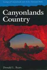
An easy-to-read geological history of the amazing red rock landscapes in southeastern Utah.

Towering red buttes, plunging canyon walls, domes, pinnacles, spires, ten thousand strangely carved forms—what visitor hasn’t marveled at the land of rock in southeastern Utah that is Canyonlands Country?

Canyonlands Country offers a unique geological history of this awesome landscape, in language understandable by the non-geologist. The story is as strange and fascinating as the land itself. Each exposed rock layer has a different geologic history: one is a stream deposit, another is an ancient field of dunes, another was deposited by shallow tropic seas. The Green and Colorado Rivers began carving canyons thirty million years ago, but to understand such relatively recent events Canyonlands Country takes us on a journey of two billion years.

Tours include Arches National Park, Island in the Sky, Needles District, The Maze and Elaterite Basin, Labyrinth and Stillwater Canyons, Meander Canyon, and Cataract Canyon.

[more]

front cover of The Changing Arctic Landscape
The Changing Arctic Landscape
Ken Tape
University of Alaska Press, 2010
With this book, photographer Ken Tape sets changes in the landscape in stark relief, pairing decades-old photos of the arctic landscape of Alaska with photos of the same scenes taken in the present. 

The resulting volume is a stunning reminder of inexorable change; divided into sections on vegetation, permafrost, and glaciers, the images show the startling effects of climate change. In addition, each section presents a short biography of a pioneering scientist who was instrumental in both obtaining the antique photographs and advancing the study of arctic ecosystems, as well as interviews with scientists who have spent decades working in Alaska for the United States Geological Survey. The Changing Arctic Landscape is a profile of transformation—complex and not yet fully understood.
[more]

logo for Harvard University Press
Color Atlas of the Surface Forms of the Earth
Helmut Blume and R. Gardner
Harvard University Press, 1992
This color atlas describes the manifold landforms of the earth's surface and explains how they evolved. The author has selected photos from all over the world in order to achieve a rather complete and systematic survey. In general as well as in explaining photos, the text is both concise and easily readable even for the general reader looking for information on landforms, morphodynamic processes, and also for explanation of geomorphic terms. Text, figures, and photos are arranged in a most didactic way so that the color atlas may serve as an introduction to the subject of geomorphology.
[more]

front cover of The Color of Rock
The Color of Rock
A Novel
Sandra Cavallo Miller
University of Nevada Press, 2019

A young physician, Dr. Abby Wilmore, attempts to escape her past by starting over at the Grand Canyon Clinic. Silently battling her own health issues, Abby struggles with adjusting to the demands of this unique rural location. She encounters everything from squirrel bites to suicides to an office plagued by strong personalities. While tending to unprepared tourists, underserved locals, and her own mental trials, Abby finds herself entangled in an unexpected romance and trapped amidst a danger even more treacherous than the foreboding desert landscape.

Sandra Cavallo Miller’s debut novel transports readers to the beautiful depths of Arizona and weaves an adventurous and heartwarming tale of the courage and strength it takes to overcome personal demons and to find love.

[more]

front cover of Contributions from the Museum of Geology, University of Michigan
Contributions from the Museum of Geology, University of Michigan
Volume II
Edited by Eugene S. McCartney
University of Michigan Press, 1928
This volume features a collection of papers originally published between July 10, 1924, and August 3, 1927, and edited by Eugene S. McCartney. Most, but not all, of the contributors were members of the faculties or graduates of the University of Michigan who published on their findings while examining fossils and rock formations. Many of the articles discuss findings from the state of Michigan, including “Occurrence of the Collingwood Formation in Michigan.”
[more]

front cover of Crossing the Rift
Crossing the Rift
Resources, Settlements Patterns and Interaction in the Wadi Arabah
P. Bienkwoski
Council for British Research in the Levant, 2006
Most of the papers published in this volume were originally presented at a conference of the same name, organised by the editors, and held in Atlanta, Georgia, in November 2003. The Wadi Arabah falls between the two areas of southern Jordan and Negev, and has traditionally been seen as a barrier and border. This book (and the conference it came out of) is an attempt to look at this neglected area anew: bridge, rather than barrier.
[more]


Send via email Share on Facebook Share on Twitter